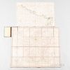
Five Cartographic Works on France. Carte des Environs de Paris, Paris: Chez Jean, 1810, foldout map of Paris and surrounding country, b
Lot 1352
About Seller
Bonhams Skinner
274 Cedar Hill Street
Marlborough, MA 01752
United States
Founded over four decades ago, Bonhams Skinner offers more than 60 auctions annually. Bonhams Skinner auctions reach an international audience and showcase the unique, rare, and beautiful in dozens of categories, including the fine and decorative arts, jewelry, modern design, musical instruments, sc...Read more
Categories
About Auction
Catalog Only
By Bonhams Skinner
Nov 2, 2020 - Nov 12, 2020
Set Reminder
2020-11-02 12:00:00
2020-11-12 19:00:00
America/New_York
Bidsquare
Bidsquare : Fine Books & Manuscripts
https://www.bidsquare.com/auctions/skinner/fine-books-manuscripts-5907
Skinner’s November Rare Books and Manuscripts Auction leads off with a stunning collection of photographic books along with important literary works, Manuscripts, maps, letters and even an extensive collection of 700 autographs. Bonhams Skinner bidsquare@bonhamsskinner.com
Skinner’s November Rare Books and Manuscripts Auction leads off with a stunning collection of photographic books along with important literary works, Manuscripts, maps, letters and even an extensive collection of 700 autographs. Bonhams Skinner bidsquare@bonhamsskinner.com
- Lot Description
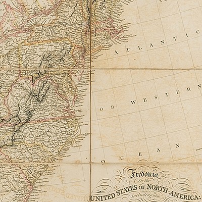
Five Cartographic Works on France. Carte des Environs de Paris, Paris: Chez Jean, 1810, foldout map of Paris and surrounding country, bound in red-orange paper with paper title label on front cover, partially hand-colored, 22 x 31 in.; Andriveau-Goujon, J., Routes et Chemins de Fer de la France, Paris: 1856, foldout map of major roads and railways of France, regions differentiated with color, mounted on cream cloth, bound in green cloth, blind stamped on front and back covers, gilt-lettered title on front cover, some tearing along fold lines, 33 x 38 1/4 in.; Map of the Northern Part of France to Facilitate the Knowledge of the Operations Carried on by the Allied Armies against the French Conventional Troops, London: William Faden, 1793, foldout map dissected into 16 sections and mounted on off-white cloth, some hand-coloring, housed in marbled paper slipcase with paper title label, 21 3/4 x 31 1/2 in.; Plan Routier de la Ville et Fauxbourgs de Paris Divise en 12 Municipalites, Paris: Chez Jean, 1812, foldout map of Paris with legend and hand-coloring, bound in orange paper with paper title label, some damage to spine of binding, 22 x 32 3/4 in.; Moomen, C., Paris Since the War, Paris: C. Moomen, 1873, first edition, signed by author with inscription on ffep, guidebook for visiting the sights of Paris, bound in blue cloth with gilt-lettering on front cover, two foldout maps, 7 x 4 1/2 in.
Any condition statement is given as a courtesy to a client, is only an opinion and should not be treated as a statement of fact. Skinner Inc. shall have no responsibility for any error or omission. The absence of a condition statement does not imply that the lot is in perfect condition or completely free from wear and tear, imperfections or the effects of aging. - Shipping Info
-
Please visit http://www.skinnerinc.com/services/payment-and-shipping/ for information regarding the collection of items purchased at auction.
-
- Buyer's Premium


 EUR
EUR CAD
CAD AUD
AUD GBP
GBP MXN
MXN HKD
HKD CNY
CNY MYR
MYR SEK
SEK SGD
SGD CHF
CHF THB
THB


