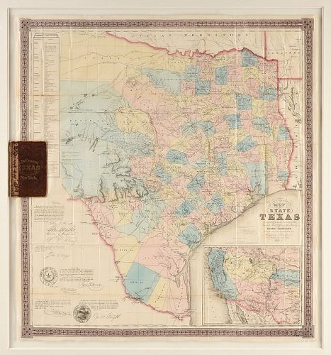
AN ANTEBELLUM MAP, "J. De Cordova's Map of the State of Texas," NEW YORK, 1856,
About Seller
6116 Skyline Drive, Suite 1
Houston, TX 77057
United States
Simpson Galleries has been serving Houston’s need for the very best in antique sales venues for more than fifty years. Beginning in 1962, William Simpson started educating himself and others in the art of collecting fine antiques and art objects. Simpson Galleries' commitment to excellence and accur...Read more
Two ways to bid:
- Leave a max absentee bid and the platform will bid on your behalf up to your maximum bid during the live auction.
- Bid live during the auction and your bids will be submitted real-time to the auctioneer.
Bid Increments
| Price | Bid Increment |
|---|---|
| $0 | $25 |
| $500 | $50 |
| $1,000 | $100 |
| $2,000 | $250 |
| $5,000 | $500 |
| $10,000 | $1,000 |
| $20,000 | $2,500 |
| $50,000 | $5,000 |
| $100,000 | $10,000 |
| $200,000 | $25,000 |
About Auction
Feb 15, 2020
Including important Maps, Audubon Havell prints; works by artists Lee N. Smith, Billy Hassell, Frank Reaugh, Porfirio Salinas, Richard MacDonald, Tsing-Fang Chen, Charles Schorre, Leroy Neiman, and Arman; and a painting by the fourth man to walk on the moon, Alan Bean. Simpson Galleries online_auctions@simpsongalleries.com
- Lot Description
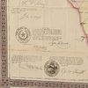
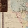
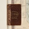
AN ANTEBELLUM MAP, "J. De Cordova's Map of the State of Texas," NEW YORK, 1856, hand colored lithograph on paper, with hand inscribed pencil inscriptions, the campaign notes beginning near Brownsville, followed by raspberry red dots on important cities/locations/forts following a route traveling north to Cooke, Bosque and Denton Counties, which have triangular and square outlined areas, one reads, "Camp Cooper," a final dot within Indian Territory at Fort Washita; "Compiled from the records of the General Land Office of the State by Robert Creuzbaur, Revised and Corrected by Charles W. Pressler," J.H. Colton & Co, Publishers, J.M. Atwood, Engraver, "Entered according to Act of Congress in the year 1856 by J. De Cordova in the Clerk's Office of the United States District Court for the District of Texas," within a Gothic revival lozenge and quatrefoil chain border, all signatures in plate, with seal of The State of Texas and General Land Office, framed with the original gilt tooled brown leather book front and back cover boards. 36" x 33 1/2" Note: "The First Map of Texas Made by a Houstonian. Few can match the efforts of Jacob de Cordova in promoting land development in Texas...the de Cordova Map of Texas was one of the first examples of a map which relied on the records of the General Land Office. De Cordova was a land promoter from New Orleans, had been a printer in Philadelphia, settled in Houston and following a term in the State Legislature, remained there and established the Texas Herald." Furthermore, The Texas Handbook Online writes about Camp Cooper, "It was established by the Texas legislature in January 1856 and named for United States Army Adjutant General Samuel Cooper. Its mission was to protect the frontier and to monitor the nearby Comanche Indian reservation. The area had been a campsite for three companies of the Fifth Infantry in 1851... The post was founded by Col. Albert Sidney Johnston in January 1856 and became headquarters for four companies of the Second United States Cavalry under the command of Lt. Col. Robert E. Lee. This was Lee's first command of a fort. He remained in charge for fifteen months, from April 9, 1856, until July 22, 1857...Although the camp initially had adequate military stores, it was plagued by severe weather, insects, dust, and irregular supply trains. Rattlesnakes were constant visitors, and Lee kept one as a pet. When he left the camp in 1857 for San Antonio, Maj. George H. Thomas took over." Further research into the three areas drawn in pencil on this map is required to accurately identify what exactly these areas are and if they are any of the military encampments mentioned herein. The hand drawings and specific fort notation show a much needed organized supply route from the coast to these Texas frontier outposts. Provenance: Property from a Corporate Collection, Houston, Texas.Some creases as issued, bends and handling creases throughout, mild tears and losses, small rubbed holes, but overall expected tone and foxing, but overall in good to very good condition, wear commensurate with age and use. Simpson Galleries strongly encourages in-person inspection of items by the bidder. Statements by Simpson Galleries regarding the condition of objects are for guidance only and should not be relied upon as statements of fact and do not constitute a representation, warranty, or assumption of liability by Simpson Galleries. All lots offered are sold "AS IS."
Condition
- Shipping Info
-
**SIMPSON GALLERIES, LLC. DOES NOT PROVIDE SHIPPING SERVICES OR SHIPPING QUOTES.** Shipping may be secured through - The UPS Store: auctions@epicpartnershipco.com 281-764-9551, The UPS Store: store3229@theupsstore.com 713-334-8869, PACK-N-SEND: sales@pack-n-send.com 713-266-1450, ACTS Crating and Transportation Services: crating@actsintl.com 713-869-2269, NAVIS Pack & Ship: 17013tx@gonavis.com 713-352-3038, Wintersteen Trucking: wintersteentrucking@yahoo.com 800-253-0617, or the shipper of your choice.
-
- Buyer's Premium


 EUR
EUR CAD
CAD AUD
AUD GBP
GBP MXN
MXN HKD
HKD CNY
CNY MYR
MYR SEK
SEK SGD
SGD CHF
CHF THB
THB