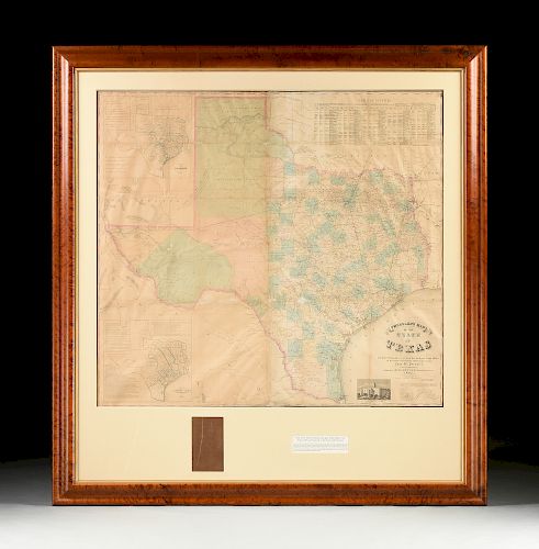
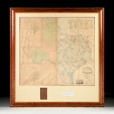
A RARE ANTIQUE CIVIL WAR ERA MAP, "Pressler's Map of the State of Texas," THE STRAND, GALVESTON, 1862,
About Seller
6116 Skyline Drive, Suite 1
Houston, TX 77057
United States
Simpson Galleries has been serving Houston’s need for the very best in antique sales venues for more than fifty years. Beginning in 1962, William Simpson started educating himself and others in the art of collecting fine antiques and art objects. Simpson Galleries' commitment to excellence and accur...Read more
Two ways to bid:
- Leave a max absentee bid and the platform will bid on your behalf up to your maximum bid during the live auction.
- Bid live during the auction and your bids will be submitted real-time to the auctioneer.
Bid Increments
| Price | Bid Increment |
|---|---|
| $0 | $25 |
| $500 | $50 |
| $1,000 | $100 |
| $2,000 | $250 |
| $5,000 | $500 |
| $10,000 | $1,000 |
| $20,000 | $2,500 |
| $50,000 | $5,000 |
| $100,000 | $10,000 |
| $200,000 | $25,000 |
About Auction
Sep 22, 2019
Works by Anthony DeYoung, Porfirio Salinas, Robert Wood, Frank Reaugh, Charles Umlauf - and more recent artists Dorothy Hood, Basilios Poulos, Billy Hassell, John Alexander, Ida Kohlmeyer, and George Rodrique. Traditional paintings by American and European masters such as Édouard Cortés, Robert Reid Simpson Galleries online_auctions@simpsongalleries.com
- Lot Description
A RARE ANTIQUE CIVIL WAR ERA MAP, "Pressler's Map of the State of Texas," THE STRAND, GALVESTON, 1862, hand colored engraving on paper, "Compiled from the Records of the General Land Office...by Chas. M. Pressler, Principal draftsman...," published by Jones Root & Co., signed in plate by Commissioner of the General Land Office of the State of Texas, Stephen Crosby (1808-1869), also with two sub maps, "Map of Original Land Districts," and "Map of the Old Colonies," and a "Table of Counties," with vignette showing the original 1852-1853 "State Capitol at Austin," framed with original leather front board. 46 1/2" x 51" Note: The American and Texan landscape teemed with uncertain energy in 1862. The North and South were in the midst of the American Civil War, and in September of the same year President Abraham Lincoln issued the Emancipation Proclamation. Charles W. Pressler, immigrated to Texas in 1846, establishing himself as a surveyor first with Jacob De Cordova. Pressler lead surveying expeditions for the active surveyor; later establishing a career with the General Land Office of the State of Texas in 1850, serving as Principal Draftsman from 1858-1865. It is during this time that Pressler and colleagues were commissioned to produce the present map. Argued as "unquestionably the finest map of Texas of its period," this map improved the State of Texas and the United States' understanding of Texas' geography. Parts of West Texas were still uncharted at this time in history. The map shows the actual and proposed network of railroad lines throughout Texas, indicating population and inhabited areas of the largely undeveloped West Texas territory. The map also details post offices, trails, and roads giving the viewer insight into land travel throughout the State of Texas during the mid 19th century. Outside of man-made transportation routes, the single most detailed part of this map is the extensive system of waterways that surround and run through Texas. The information regarding early colonies, at once, gives the viewer a deep history of the overall cultivation of the State. Indigenous territories are found near the Red River, the map lacking Greer county, which appears in later editions. Finally, an engraving of the State Capitol at Austin is so unusual to see; very few renderings of this building remain. The current State Capitol, which was built in the late 19th century now rests over the foundation of the original 1850s structure. The map was so well informed and drafted that not only the State of Texas, but also the United States Federal government consulted this map and later editions when resolving land disputes in the 19th century. An incredibly rare printing, this map captures the unsettled Texas landscape during the upheaval of the American Civil War. Provenance: Property from a Fortune 500 Energy Company, Houston, Texas.Professional restoration and repairs including overlaid mesh support, various inpainting, losses, tears, creases, left side with notable yellow toning and foxing spots, waves, bubbling, but overall in good condition, wear commensurate with age and use. Simpson Galleries strongly encourages in-person inspection of items by the bidder. Statements by Simpson Galleries regarding the condition of objects are for guidance only and should not be relied upon as statements of fact and do not constitute a representation, warranty, or assumption of liability by Simpson Galleries. All lots offered are sold "AS IS."
Condition
- Shipping Info
-
**SIMPSON GALLERIES, LLC. DOES NOT PROVIDE SHIPPING SERVICES OR SHIPPING QUOTES.** Shipping may be secured through - The UPS Store: store2567@theupsstore.com 281-764-9551, The UPS Store: store3229@theupsstore.com 713-334-8869, PACK-N-SEND: sales@pack-n-send.com 713-266-1450, ACTS Crating and Transportation Services: crating@actsintl.com 713-869-2269, NAVIS Pack & Ship: 17013tx@gonavis.com 713-352-3038, Wintersteen Trucking: wintersteentrucking@yahoo.com 800-253-0617, or the shipper of your choice.
-
- Buyer's Premium


 EUR
EUR CAD
CAD AUD
AUD GBP
GBP MXN
MXN HKD
HKD CNY
CNY MYR
MYR SEK
SEK SGD
SGD CHF
CHF THB
THB


