Apollo 17 Lunar Surface-Used Rover Map Signed by Gene Cernan
Two ways to bid:
- Leave a max absentee bid and the platform will bid on your behalf up to your maximum bid during the live auction.
- Bid live during the auction and your bids will be submitted real-time to the auctioneer.
Bid Increments
| Price | Bid Increment |
|---|---|
| $0 | $5 |
| $50 | $10 |
| $200 | $25 |
| $500 | $50 |
About Auction
Apr 25, 2024
Featuring nearly 400 items, RR's Spring Space Exploration auction is filled with flown material, astronaut autographs, Apollo hardware, and other space rarities. RR Auction support@rrauction.com
- Lot Description
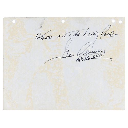
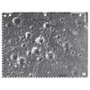
Remarkable photographic lunar map used aboard the Lunar Roving Vehicle on the surface of the moon during Apollo 17, one page, 10.5 x 8, signed and flight-certified on the reverse in black felt tip, "Used on the Lunar Rover—Gene Cernan, Apollo XVII." The important map shows the area of the Taurus-Littrow valley explored during the three planned Apollo 17 EVAs, identifying numerous craters including 'Camelot,' 'Sputnik,' 'Faust,' and 'Snoopy.' In fine condition.
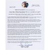
Accompanied by a detailed signed letter of provenance from Cernan, explaining his extensive use of the map on the surface of the moon. In full: “This is to certify that the accompanying Lunar Rover Photo Map labeled 'EVA 1: 1 of 1 / EVA 2: 1 of 3,' was used by me to help navigate while driving the Apollo 17 lunar rover on the Moon. As part of the last lunar mission of the Apollo program, I flew the lunar module 'Challenger' to a landing in the Valley of Taurus-Littrow during the flight of Apollo 17 on December 11, 1972.
While on the Moon, Harrison 'Jack' Schmitt and I, drove a lunar rover during our exploration of Taurus-Littrow. We had a series of maps specifically intended for use in conjunction with our lunar rover to navigate across the valley's surface. The maps were contained in the book, 'LM Lunar Surface Maps,' which was carried in the rover on the lunar surface.
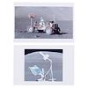
The book was instrumental in the successful accomplishment of our tasks on the Moon's surface. As I moved around the rover on the first EVA, my hammer caught one of the rear fenders of the rover and broke the fender. Map plates from the map book were used to construct a makeshift fender that was attached to the rover by Utility Bracket Clamps from the lunar module. That replacement fender allowed us to drive on the surface without being blanketed by lunar dust and complete our mission on the surface of the Moon.
This map plate labeled 'EVA 1:1 of 1/EVA 2: 1 of 3' is a photographic map designed to show the major portion of our first and second EVAs as well as a minor portion of our third EVA at Taurus-Littrow. This map shows the approximate position of our LM and parts of our projected EVAs. The map also shows 'Station 5' which was one of our most important stops during our second EVA. It was at the crater 'Camelot' (named in honor of John F. Kennedy's presidency) that we were to determine that the sub-floor (bedrock) was created by slow cooled underground magma, called 'Gabbro,' to form the floor of the valley. The 'Gabbro' find was an important geological clue to the formation of the Taurus-Littrow region.
This lunar rover map has spent 22 hours and 3 minutes on the lunar surface as was exposed to the temperature extremes, radiation and Solar wind within the vacuum of deep space.
During the Apollo Program, NASA allowed astronauts to keep disposable items like this lunar rover map from their missions as personal mementos, and, as such, it was presented to me after my flight in 1972.
This lunar rover map is one of the few objects actually used directly on the Moon's surface and is also a rare example of an astronaut flight-certified artifact returned from the lunar surface." - Shipping Info
-
Bidder is liable for shipping and handling and providing accurate information as to shipping or delivery locations and arranging for such. RR Auction is unable to combine purchases from other auctions or affiliates into one package for shipping purposes. Lots won will be shipped in a commercially reasonable time after payment in good funds for the merchandise and the shipping fees are received or credit extended, except when third-party shipment occurs. Bidder agrees that service and handling charges related to shipping items which are not pre-paid may be charged to a credit card on file with RR Auction. Successful international Bidders shall provide written shipping instructions, including specified Customs declarations, to RR Auction for any lots to be delivered outside of the United States. NOTE: Declaration value shall be the item’(s) hammer price and RR Auction shall use the correct harmonized code for the lot. Domestic Bidders on lots designated for third-party shipment must designate the common carrier, accept risk of loss, and prepay shipping costs.
-
- Buyer's Premium


 EUR
EUR CAD
CAD AUD
AUD GBP
GBP MXN
MXN HKD
HKD CNY
CNY MYR
MYR SEK
SEK SGD
SGD CHF
CHF THB
THB