Maps of Various United States of America
Lot 187
About Seller
Revere Auctions
755 Prior Ave N, #235C
St. Paul, MN 55104
United States
Revere Auctions is a premier auction house located in Saint Paul, Minnesota.
Categories
Estimate:
$200 - $300
Absentee vs Live bid
Two ways to bid:
- Leave a max absentee bid and the platform will bid on your behalf up to your maximum bid during the live auction.
- Bid live during the auction and your bids will be submitted real-time to the auctioneer.
Bid Increments
| Price | Bid Increment |
|---|---|
| $0 | $25 |
| $300 | $50 |
| $1,000 | $100 |
| $3,000 | $200 |
| $7,000 | $500 |
| $10,000 | $1,000 |
| $20,000 | $2,000 |
| $50,000 | $5,000 |
| $100,000 | $10,000 |
| $500,000 | $25,000 |
| $1,000,000 | $50,000 |
| $10,000,000 | $100,000 |
About Auction
By Revere Auctions
Jan 13, 2020
Set Reminder
2020-01-13 13:00:00
2020-01-13 13:00:00
America/New_York
Bidsquare
Bidsquare : Fine Books, Maps, and Manuscripts
https://www.bidsquare.com/auctions/revere-auctions/fine-books-maps-and-manuscripts-4781
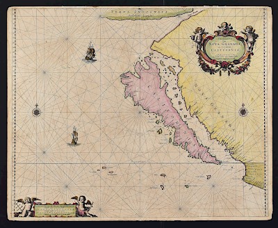
An auction featuring an impressive collection of books and maps, including several notable cartographic depictions of California as an island, first editions of notable books including Sir Richard Burton’s “1001 Nights,” and a page from the Nuremberg Chronicle. Revere Auctions info@revereauctions.com
An auction featuring an impressive collection of books and maps, including several notable cartographic depictions of California as an island, first editions of notable books including Sir Richard Burton’s “1001 Nights,” and a page from the Nuremberg Chronicle. Revere Auctions info@revereauctions.com
- Lot Description
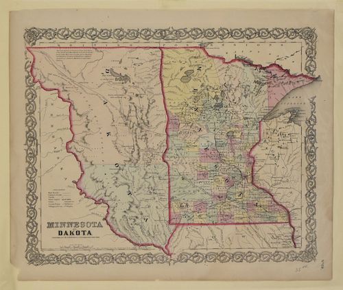
Large group of 19th and 20th century maps of parts of the United States. F. H. Gerdes (1809-1884) "U. S. Coast Survey Preliminary Chart of Ship Island Shoal Louisiana" U.S. Coast Survey, Washington DC, 1853; Laurel Motor Inn "Map of San Francisco" Peerless Co., San Francisco, 1969; Colton's Hand Colored Map of "Minnesota" with a portion of "Michigan and Wisconsin" on verso; Hinton, Simpkin, and Marshall, "Map of the State of New York with Part of Upper Canada" Fenner Sears & Co., London, 1831; The Office of the Coast Survey (1807-present) Map of the "Entrances to Cape Fear River North Carolina" 1866; "U. S. Coast Survey Entrance to Pascagoula River, Mississippi" U.S. Coast Survey, Washington DC, 1853; "San Francisco" Published for the History of the World by Henry Bill, New York, 1854; "U. S. Coast Survey Horn Island Pass, Mississippi Sound" U.S. Coast Survey, Washington DC, 1852; "U. S. Coast Sketch F Showing the Progress of the Survey in Section VI with a General Reconnoissance of the Western Coast of Florida" U.S. Coast Survey, Washington DC, 1848-51; Joseph Meyer (1796-1856) Map of "Philadelphia. Aus der Geographischen Graviranstalt des Bibliographischen Instituts zu Hildburghausen, Amsterdam, Paris u. Philadelphia,"; O. W. Gray & Son Hand Colored Map of "San Francisco" and a portion of "California and Nevada" on verso, ca. 1875; J. H. Colton & Co. Map of "Minnesota and Dakota" New York, 1855; Hand colored "Page's Map of Dakota, 1885," H. R. Page & Co., Chicago, 1885.
SKU: 03555
Follow us on Instagram: @revereauctions
Please contact us for a detailed condition report. Please note that the lack of a condition statement does not imply perfect condition. Email condition@revereauctions.com with any condition questions.Condition
- Shipping Info
-
Please contact Revere Auction house for a shipping estimate.
-
- Buyer's Premium


 EUR
EUR CAD
CAD AUD
AUD GBP
GBP MXN
MXN HKD
HKD CNY
CNY MYR
MYR SEK
SEK SGD
SGD CHF
CHF THB
THB


