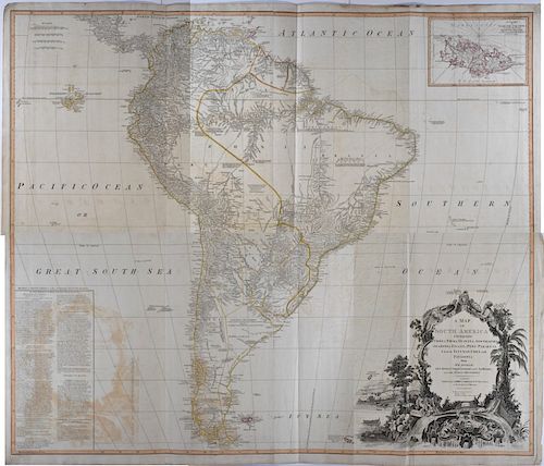
Large D'Anville Wall Map of South America 1794
Lot 134
About Seller
Revere Auctions
755 Prior Ave N, #235C
St. Paul, MN 55104
United States
Revere Auctions is a premier auction house located in Saint Paul, Minnesota.
Categories
Estimate:
$500 - $700
Absentee vs Live bid
Two ways to bid:
- Leave a max absentee bid and the platform will bid on your behalf up to your maximum bid during the live auction.
- Bid live during the auction and your bids will be submitted real-time to the auctioneer.
Bid Increments
| Price | Bid Increment |
|---|---|
| $0 | $25 |
| $300 | $50 |
| $1,000 | $100 |
| $3,000 | $200 |
| $7,000 | $500 |
| $10,000 | $1,000 |
| $20,000 | $2,000 |
| $50,000 | $5,000 |
| $100,000 | $10,000 |
| $500,000 | $25,000 |
| $1,000,000 | $50,000 |
| $10,000,000 | $100,000 |
About Auction
By Revere Auctions
Jan 13, 2020
Set Reminder
2020-01-13 13:00:00
2020-01-13 13:00:00
America/New_York
Bidsquare
Bidsquare : Fine Books, Maps, and Manuscripts
https://www.bidsquare.com/auctions/revere-auctions/fine-books-maps-and-manuscripts-4781
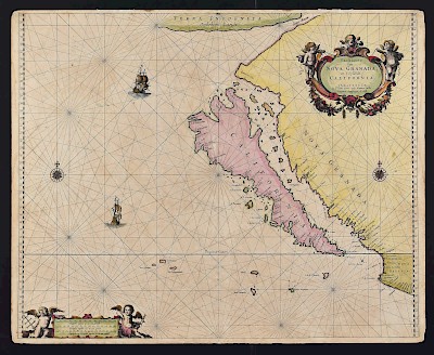
An auction featuring an impressive collection of books and maps, including several notable cartographic depictions of California as an island, first editions of notable books including Sir Richard Burton’s “1001 Nights,” and a page from the Nuremberg Chronicle. Revere Auctions info@revereauctions.com
An auction featuring an impressive collection of books and maps, including several notable cartographic depictions of California as an island, first editions of notable books including Sir Richard Burton’s “1001 Nights,” and a page from the Nuremberg Chronicle. Revere Auctions info@revereauctions.com
- Lot Description
A stunning wall map based on d'Anville's map of South America, including new discoveries by explorers along the coast, printed over two sheets and published by Laurie & Whittlemin 1794. This was likely originally bound into a large scale world atlas, the most common of which were the various printings of Kitchin's General Atlas. The continent is shown in its entirety, from the Caribbean in the North, labelled here as the 'North Sea of the Spaniards,' to the southernmost tip of the Tierra del Fuego and the Falklands. The Galapagos, off the western coast off the continent, are also given the whimsical title of the 'Inchanted Isles,' a direct English translation of their former Spanish name, Las Encantadas. The map features numerous notes of geographic, ethnographic, and historic interest, and to the left, in the Pacific Ocean, a large boxed text features a description of the 'Division of South America with a Summary Account of its Trade'. At the top right corner, an inset boxed chart shows the Falkland Islands, 'named by the French Malouine Islands, and discovered by Hawkins in the year 1595'. The map is outlined in hand color, and features a large baroque title cartouche assembled from floral and faunal emblems of the continent in the bottom right corner.
SKU: 03530
Follow us on Instagram: @revereauctions
Good condition, some creasing, some of the images have faintly transferred to areas that the images have pressed onto the surface.Condition
- Shipping Info
-
Please contact Revere Auction house for a shipping estimate.
-
- Buyer's Premium


 EUR
EUR CAD
CAD AUD
AUD GBP
GBP MXN
MXN HKD
HKD CNY
CNY MYR
MYR SEK
SEK SGD
SGD CHF
CHF THB
THB


