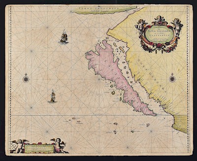
Grp: Maps of Iberia and France
Lot 28
About Seller
Revere Auctions
755 Prior Ave N, #235C
St. Paul, MN 55104
United States
Revere Auctions is a premier auction house located in Saint Paul, Minnesota.
Categories
Estimate:
$300 - $500
Absentee vs Live bid
Two ways to bid:
- Leave a max absentee bid and the platform will bid on your behalf up to your maximum bid during the live auction.
- Bid live during the auction and your bids will be submitted real-time to the auctioneer.
Bid Increments
| Price | Bid Increment |
|---|---|
| $0 | $25 |
| $300 | $50 |
| $1,000 | $100 |
| $3,000 | $200 |
| $7,000 | $500 |
| $10,000 | $1,000 |
| $20,000 | $2,000 |
| $50,000 | $5,000 |
| $100,000 | $10,000 |
| $500,000 | $25,000 |
| $1,000,000 | $50,000 |
| $10,000,000 | $100,000 |
About Auction
By Revere Auctions
Jan 13, 2020
Set Reminder
2020-01-13 13:00:00
2020-01-13 13:00:00
America/New_York
Bidsquare
Bidsquare : Fine Books, Maps, and Manuscripts
https://www.bidsquare.com/auctions/revere-auctions/fine-books-maps-and-manuscripts-4781
An auction featuring an impressive collection of books and maps, including several notable cartographic depictions of California as an island, first editions of notable books including Sir Richard Burton’s “1001 Nights,” and a page from the Nuremberg Chronicle. Revere Auctions info@revereauctions.com
An auction featuring an impressive collection of books and maps, including several notable cartographic depictions of California as an island, first editions of notable books including Sir Richard Burton’s “1001 Nights,” and a page from the Nuremberg Chronicle. Revere Auctions info@revereauctions.com
- Lot Description
Group of maps of the Iberian Peninsula and France, including many early maps of Spain and Portugal. Includes Joh. Bapt. Homannum "Regnum Portugalliae, divisum in Quinque Provincias majores & subdivisum in sua quaeque Territoria una cum Regno Algarbiae," Nuremberg, I.B. Nolin, 1736; Vernando Alvero Secco, "Portugallia et Algarbi quae olim Lusitania," Amsterdam: Joannes Jansson, ca. 1666; J. Asperne, "Spain and Portugal," from "European Magazine," 1st November 1808; Thomas Kitchin (1718–1784), "A Chart of the Straits of Gibraltar with the adjacent Ocean, and Coasts of Spain and Portugal, where the late Engagement between Adm[iral] Boscawen & the French happened, and where so many of the French Ships were taken or burnt," for London Magazine; two maps by Edward Wells, dedicated to William, Duke of Gloucester, and engraved by Robert Spofforth: "A New Map of Ancient Gaul or Gallia Transalpina Sharing the Divisions thereof by Augustus Caesar together with its principal People, Cities, Townes, Rivers, Mountains: & c," and “A New Map of Iberia Europe alias Celtiberia, or Ancient Spain, Shewing its Principal Divisions, Chief Cities, Townes, Rivers, Mountains, & c.,” both ca. early 18th c.; "Le Royame de France," from a 17th c. Dutch book; Frederick de Wit (ca. 1630–1706), "Totis Regnorum Hispaniae et Portugalliae descriptio," Amsterdam, ca. 1680; Emanuel Bowen (ca. 1694–1767), "A New and Accurate Map of France with it's Aquisitions [sic]. Composed from the latest Surveys, assisted by the most approved modern Maps & Charts, & Regulated by Astron[omica]l Observat[io]ns," London, 1747.
SKU: 03600
Follow us on Instagram: @revereauctions
Please contact us for a detailed condition report. Please note that the lack of a condition statement does not imply perfect condition. Email condition@revereauctions.com with any condition questions.Condition
- Shipping Info
-
Please contact Revere Auction house for a shipping estimate.
-
- Buyer's Premium


 EUR
EUR CAD
CAD AUD
AUD GBP
GBP MXN
MXN HKD
HKD CNY
CNY MYR
MYR SEK
SEK SGD
SGD CHF
CHF THB
THB


