Grp: 9 Maps of South America
Lot 130
About Seller
Revere Auctions
755 Prior Ave N, #235C
St. Paul, MN 55104
United States
Revere Auctions is a premier auction house located in Saint Paul, Minnesota.
Categories
Estimate:
$200 - $300
Absentee vs Live bid
Two ways to bid:
- Leave a max absentee bid and the platform will bid on your behalf up to your maximum bid during the live auction.
- Bid live during the auction and your bids will be submitted real-time to the auctioneer.
Bid Increments
| Price | Bid Increment |
|---|---|
| $0 | $25 |
| $300 | $50 |
| $1,000 | $100 |
| $3,000 | $200 |
| $7,000 | $500 |
| $10,000 | $1,000 |
| $20,000 | $2,000 |
| $50,000 | $5,000 |
| $100,000 | $10,000 |
| $500,000 | $25,000 |
| $1,000,000 | $50,000 |
| $10,000,000 | $100,000 |
About Auction
By Revere Auctions
Jan 13, 2020
Set Reminder
2020-01-13 13:00:00
2020-01-13 13:00:00
America/New_York
Bidsquare
Bidsquare : Fine Books, Maps, and Manuscripts
https://www.bidsquare.com/auctions/revere-auctions/fine-books-maps-and-manuscripts-4781
An auction featuring an impressive collection of books and maps, including several notable cartographic depictions of California as an island, first editions of notable books including Sir Richard Burton’s “1001 Nights,” and a page from the Nuremberg Chronicle. Revere Auctions info@revereauctions.com
An auction featuring an impressive collection of books and maps, including several notable cartographic depictions of California as an island, first editions of notable books including Sir Richard Burton’s “1001 Nights,” and a page from the Nuremberg Chronicle. Revere Auctions info@revereauctions.com
- Lot Description
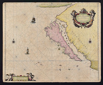
Group of nine maps of South America. Includes Alexander Hogg (1778-1824), "The North Side of the largest of Queen Charloue's Islands as it appeared running along shore to the Westward" London, ca. 1790; two maps of Patagonia by J. H. Colton, New York, 1855; James Cook (1728-1779) hand colored map of Success Bay in Strait le Maire, "Plan de la Baye du bon Succes dans le Detroit de le Maire," Benard, 1769; Rigobert Bonne (1727-1794) hand colored map of Peru, "Carte du Perou ou se trouvent les Audiences de Quito, Lima et la Plata" Paris, ca. 1772; Emanuel Bowen (ca. 1694-1767) "A new & accurate map of the island of Cuba. A new & accurate map of the islands of Hispaniola or St. Domingo and Porto Rico.," London, ca. 1752; Emanuel Bowen (ca. 1694-1767) "An Accurate Map of the West Indies, drawn from the best authorities, assisted by the most approved modern maps and charts, and regulated by astronomical observations," London, ca. 1747; G. Anson map of the southern part of South America, "Carte de la Partie Meridionale de l'Amerique Meridionale," Amsterdam, ca. 1749; hand colored facsimile of Anthony Jacobsz' Map of North America, 1612, "Americae Septentrionalis Pars," Francis D'Avignon, New York, ca. 1858.
SKU: 03612
Follow us on Instagram: @revereauctions
Please contact us for a detailed condition report. Please note that the lack of a condition statement does not imply perfect condition. Email condition@revereauctions.com with any condition questions.Condition
- Shipping Info
-
Please contact Revere Auction house for a shipping estimate.
-
- Buyer's Premium


 EUR
EUR CAD
CAD AUD
AUD GBP
GBP MXN
MXN HKD
HKD CNY
CNY MYR
MYR SEK
SEK SGD
SGD CHF
CHF THB
THB


