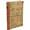
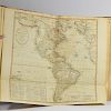
Bowles's Universal Atlas London ca. 1795
Lot 227
About Seller
Revere Auctions
755 Prior Ave N, #235C
St. Paul, MN 55104
United States
Revere Auctions is a premier auction house located in Saint Paul, Minnesota.
Categories
Estimate:
$500 - $600
Absentee vs Live bid
Two ways to bid:
- Leave a max absentee bid and the platform will bid on your behalf up to your maximum bid during the live auction.
- Bid live during the auction and your bids will be submitted real-time to the auctioneer.
Bid Increments
| Price | Bid Increment |
|---|---|
| $0 | $25 |
| $300 | $50 |
| $1,000 | $100 |
| $3,000 | $200 |
| $7,000 | $500 |
| $10,000 | $1,000 |
| $20,000 | $2,000 |
| $50,000 | $5,000 |
| $100,000 | $10,000 |
| $500,000 | $25,000 |
| $1,000,000 | $50,000 |
| $10,000,000 | $100,000 |
About Auction
By Revere Auctions
Jan 13, 2020
Set Reminder
2020-01-13 13:00:00
2020-01-13 13:00:00
America/New_York
Bidsquare
Bidsquare : Fine Books, Maps, and Manuscripts
https://www.bidsquare.com/auctions/revere-auctions/fine-books-maps-and-manuscripts-4781
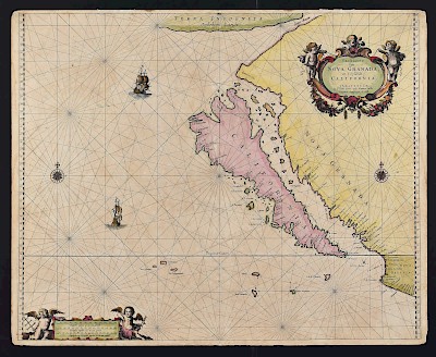
An auction featuring an impressive collection of books and maps, including several notable cartographic depictions of California as an island, first editions of notable books including Sir Richard Burton’s “1001 Nights,” and a page from the Nuremberg Chronicle. Revere Auctions info@revereauctions.com
An auction featuring an impressive collection of books and maps, including several notable cartographic depictions of California as an island, first editions of notable books including Sir Richard Burton’s “1001 Nights,” and a page from the Nuremberg Chronicle. Revere Auctions info@revereauctions.com
- Lot Description
John Palairet (1697–1774) et al., "Bowles's Universal Atlas: Being a Complete Collection of New and Accurate Maps, of all the Known Countries in the World; displaying the Whole Surface of the Terraqueous Globe, Laid Down from Correct Surveys, New Discoveries, and Authentic Documents" London: Bowles and Carver, ca. 1795. Includes engraved maps of the world, Europe, Asia, Africa, America, Great Britain and Ireland, England, Scotland, Ireland, the English Channel, Sweden and Norway, Denmark, Germany, Seven United Provinces, Lower Countries, or Netherlands,Switzerland, France, Spain and Portugal, Portugal, Italy, Hungary and European Turkey, Poland, Russia, "Discoveries made by the Russians," Land of Canaan, Coromandel Coast, Coast of Africa, North America, United States of America, New England, "Virginia, Maryland, Delaware, & c.," Jamaica, Atlantic, South America, Falkland Islands, West Indies. The map of the West Indies appears to have been added later, and has been added by hand to the table of contents.
SKU: 02165
Follow us on Instagram: @revereauctions
Please contact us for a detailed condition report. Please note that the lack of a condition statement does not imply perfect condition. Email condition@revereauctions.com with any condition questions.Condition
- Shipping Info
-
Please contact Revere Auction house for a shipping estimate.
-
- Buyer's Premium


 EUR
EUR CAD
CAD AUD
AUD GBP
GBP MXN
MXN HKD
HKD CNY
CNY MYR
MYR SEK
SEK SGD
SGD CHF
CHF THB
THB


