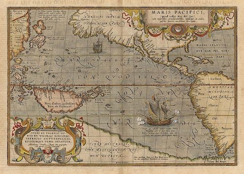
Maris Pacifici. The 1st obtainable printed map of the Pacific.
About Seller
150 Lexington Avenue
New York, NY 10016
United States
The Old Print Shop, Inc. was founded in New York City in 1988. Specialist art gallery in American art including painting, drawing and printmaking from 1700 to contemporary, antique maps and atlases, artist's books and reference books. Our staff and owners are experts in American art, assist in colle...Read more
About Auction
Jun 5, 2017 - Jun 19, 2017
The Old Print Shop, Inc info@oldprintshop.com
- Lot Description
Maris Pacifici, (quod vulgo Mar del Zur). 1589-1590.
By Abraham Ortelius.
Copper plate engraving.
Image size 13 1/2 x 19 1/2" (34.4 x 49.5 cm) plus margins.
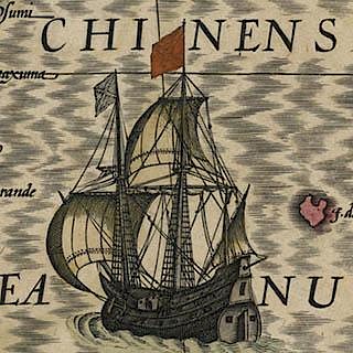
The first printed map to be devoted to the Pacific Ocean and is considered to be one of the most important maps to be published in his atlas. Circumnavigator Ferdinand Magellan's ship, "Victoria," is shown in the lower right off the coast of South America. This map also shows a prominent New Guinea and one of the earliest delineations of the Solomon Islands. This map is dated 1589 but did not appear until Ortelius issued "Additamentum IV" to his atlas in 1590. Italian text and “6” on verso.
Burden, P. "The Mapping of North America" #74; Van den Broecke “Ortelius Atlas Maps” #12.Condition
Good condition and color save for tiny stitch hole in centerfold.
- Shipping Info
-
The Old Print Ship, Inc.
150 Lexington Avenue
New York, NY 10016
-
- Buyer's Premium


 EUR
EUR CAD
CAD AUD
AUD GBP
GBP MXN
MXN HKD
HKD CNY
CNY MYR
MYR SEK
SEK SGD
SGD CHF
CHF THB
THB


