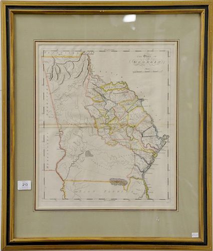
Matthew Carey (1760-1839) Set of six maps (1) A Map of the Discoveries made by Capt. Cook & Clerk in the years 1778 & 1779 between...
Lot 213
Categories
Estimate:
$300 - $500
Absentee vs Live bid
Two ways to bid:
- Leave a max absentee bid and the platform will bid on your behalf up to your maximum bid during the live auction.
- Bid live during the auction and your bids will be submitted real-time to the auctioneer.
Bid Increments
| Price | Bid Increment |
|---|---|
| $0 | $25 |
| $300 | $50 |
| $600 | $100 |
| $2,000 | $250 |
| $5,000 | $500 |
| $10,000 | $1,000 |
| $30,000 | $2,500 |
| $70,000 | $5,000 |
| $100,000 | $10,000 |
| $1,000,000 | $25,000 |
About Auction
By Nadeau's Auction Gallery
Apr 2, 2016 - Apr 3, 2016
Set Reminder
2016-04-02 11:00:00
2016-04-03 11:00:00
America/New_York
Bidsquare
Bidsquare : Important Annual Spring Antiques, Fine Art and Asian Auction
https://www.bidsquare.com/auctions/nadeaus/important-annual-spring-antiques-fine-art-and-asian-auction-1338
Nadeau's Auction Gallery info@nadeausauction.com
Nadeau's Auction Gallery info@nadeausauction.com
- Lot Description
Matthew Carey (1760-1839) Set of six maps (1) A Map of the Discoveries made by Capt. Cook & Clerk in the years 1778 & 1779 between the Eastern coast of Asia and the Western Coast of North America, When they attempted to navigate the North Sea Alfo Mr. Hearns Discoveries to the North Westward of Hudsons Bay in 1772 sight size 8 1/4" x 12" (2) A Map of the Countries Situate About the North Pole as far as the 50th Degree of North Latitude From Carey's Atlas printed and publish by T. S. Manning and Matthew Carey sight size 10 1/2" x 10" (3) William Charles after S. Lewis North Carolina sight size 13" x 19 1/2" (4) Mississippi Territory sight size 13" x 15 1/2" (5) The British Possessions in North America 1814 sight size 15 1/2" x 18 1/4" (6) The State of Georgia sight size 18 1/4" x 15 1/2" Provenance: Property from Credit Suisse's Americana Collection
- Shipping Info
-
We do not handle any shipping.We recommendCraig at the UPS Store 860-643-6264 or store0921@theupsstore.comAC Delivers 1-866-506-5477Top Delivery 860-379-3424Local (tri-state) delivery 860-246-2444
-
- Buyer's Premium


 EUR
EUR CAD
CAD AUD
AUD GBP
GBP MXN
MXN HKD
HKD CNY
CNY MYR
MYR SEK
SEK SGD
SGD CHF
CHF THB
THB


