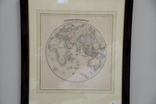
Group of three framed maps including Augustus Mitchell 1877 A Time table indicating the Difference in time between the princi
Lot 197
Categories
Estimate:
$100 - $300
Absentee vs Live bid
Two ways to bid:
- Leave a max absentee bid and the platform will bid on your behalf up to your maximum bid during the live auction.
- Bid live during the auction and your bids will be submitted real-time to the auctioneer.
Bid Increments
| Price | Bid Increment |
|---|---|
| $0 | $25 |
| $300 | $50 |
| $600 | $100 |
| $2,000 | $250 |
| $5,000 | $500 |
| $10,000 | $1,000 |
| $30,000 | $2,500 |
| $70,000 | $5,000 |
| $100,000 | $10,000 |
| $1,000,000 | $25,000 |
About Auction
By Nadeau's Auction Gallery
Jan 20, 2018 - Jan 21, 2018
Set Reminder
2018-01-20 10:00:00
2018-01-21 10:00:00
America/New_York
Bidsquare
Bidsquare : Victorian, Mahogany, Contemporary Auction
https://www.bidsquare.com/auctions/nadeaus/victorian-mahogany-contemporary-auction-2944
Nadeau's Auction Gallery info@nadeausauction.com
Nadeau's Auction Gallery info@nadeausauction.com
- Lot Description
Group of three framed maps including Augustus Mitchell 1877 A Time table indicating the Difference in time between the principal cities of the world and also showing their air-line distance from Washington (sight size 13 1/4" x 12"), Colton Eastern Hemisphere (sight size 16" x 15"), and Pennsylvania by H. Tanner (sight size 12" x 14 1/4").
- Shipping Info
-
We do not handle any shipping.We recommendCraig at the UPS Store 860-643-6264 or store0921@theupsstore.comAC Delivers 1-866-506-5477Top Delivery 860-379-3424Local (tri-state) delivery 860-246-2444
-
- Buyer's Premium


 EUR
EUR CAD
CAD AUD
AUD GBP
GBP MXN
MXN HKD
HKD CNY
CNY MYR
MYR SEK
SEK SGD
SGD CHF
CHF THB
THB


