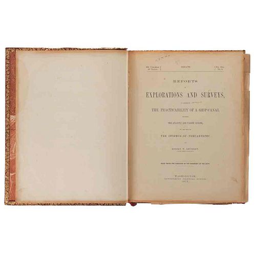
Shufeldt, Robert W. Reports of Explorations and Surveys, to Ascertain the Practicability of a Ship-Canal... Washington, 1872. 19 mapas
Lot 84
About Seller
Morton Subastas
Monte Athos 179, Lomas de Chapultepec, Lomas de Chapultepec V Secc
Mexico City, CDMX 11000
Mexico
Morton Subastas opened in 1988 as Louis C. Morton Galleries in Mexico, that same year he held his first auction. Since then, Morton Subastas has developed as the only prestigious auction house in Mexico, we have specialists in the areas of antiques, modern and contemporary art, jewelry and timepiece...Read more
Categories
Estimate:
MXN$90,000 - MXN$110,000
$4,988.91 - $6,097.56
Absentee vs Live bid
Two ways to bid:
- Leave a max absentee bid and the platform will bid on your behalf up to your maximum bid during the live auction.
- Bid live during the auction and your bids will be submitted real-time to the auctioneer.
Bid Increments
| Price | Bid Increment |
|---|---|
| MXN$0 | MXN$100 |
| MXN$1,000 | MXN$200 |
| MXN$1,200 | MXN$300 |
| MXN$1,500 | MXN$300 |
| MXN$1,800 | MXN$200 |
| MXN$2,000 | MXN$200 |
| MXN$2,200 | MXN$300 |
| MXN$2,500 | MXN$300 |
| MXN$2,800 | MXN$200 |
| MXN$3,000 | MXN$200 |
| MXN$3,200 | MXN$300 |
| MXN$3,500 | MXN$300 |
| MXN$3,800 | MXN$200 |
| MXN$4,000 | MXN$200 |
| MXN$4,200 | MXN$300 |
| MXN$4,500 | MXN$300 |
| MXN$4,800 | MXN$200 |
| MXN$5,000 | MXN$500 |
| MXN$10,000 | MXN$1,000 |
| MXN$20,000 | MXN$2,000 |
| MXN$50,000 | MXN$5,000 |
| MXN$100,000 | MXN$10,000 |
| MXN$300,000 | MXN$20,000 |
| MXN$500,000 | MXN$50,000 |
| MXN$1,000,000 | MXN$100,000 |
About Auction
By Morton Subastas
Aug 4, 2020
Set Reminder
2020-08-04 18:00:00
2020-08-04 18:00:00
America/New_York
Bidsquare
Bidsquare : Books and Documents Auction from a Mexicanista Library
https://www.bidsquare.com/auctions/morton-subastas/books-and-documents-auction-from-a-mexicanista-library-5381
Books and Documents Auction from a Mexicanista Library Morton Subastas ldiaz@mortonsubastas.com
Books and Documents Auction from a Mexicanista Library Morton Subastas ldiaz@mortonsubastas.com
- Lot Description
AF1872 - Shufeldt, Robert W.
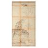
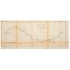
Reports of Explorations and Surveys, to Ascertain the Practicability of a Ship - Canal Between the Atlantic and Pacific Oceans, by the Way of the Isthmus of Tehuantepec. Washington: Government Printing Office, 1872. 4o. marquilla, 151 p. 19 mapas plegados: "General map of the Isthmus of Tehuantepec", 113.5 x 59 cm., rasgaduras en dobleces, pequeños faltantes, y tercio inferior desprendido; "Map Showing the route proposed for supplying with water the summit level of the Tehuantepec ship canal", 66.3 x 105 cm., rasgaduras en dobleces; "Profile No. 1; from Tarifa to the Corte, by way of Cofradia and Santa Maria", 34.6 x 120 cm., rasgaduras y faltantes, primer cuadro por desprenderse; "Profile No. 2; from Tarifa to the Corte, by way of the Feeder route", 39 x 95 cm., rasgaduras en doblez horizontal; "Profile No. 3; from Chivela to Salina Cruz, by way of Chivela Pass", 37.6 x 130 cm., rasgaduras en dobleces; "Profile No. 4; from Tarifa to Upper Lagoon, by way of Tarifa Pass", 38.3 x 75 cm., tercio inferior por desprenderse; "Profile No. 5; from the Almoloya River to Tarifa Pass, by way of Chivela Plains", 38 x 66.6 cm., rasgadura en margen interno; "Profile No. 6; from Tarifa to the Atravesado, by way of Tierra Blanca and the Chicapa Valley", 56.5 x 101.5 cm., pequeñas rasgaduras en dobleces y una en margen interno; "Chart of the Shore - Line", 51 x 95 cm., rasgaduras en dobleces; "Mouth of the Coatzacoalcos River", 93.5 x 63 cm., rasgaduras y pequeños faltantes en dobleces; "Map of the Lower Coatzacoalcos", 56 x 132.5 cm., rasgaduras en dobleces, rasgadura en margen superior, tercio derecho por desprenderse; "Comparative Charts of the Coatzacoalcos Bar", 75 x 53.5 cm., rasgaduras en dobleces; "Map of the Island of Tacamichapa", 46 x 74 cm., rasgaduras en doblez horizontal; "Reconnaissance of the Uspanapan River", 50 x 68 cm.; "Reconnaissance of the Coachapa River", 38 x 87.5 cm., rasgaduras en dobleces; "Chart of the Roadstead of Salina Cruz", 49.5 x 69.5 cm., rasgaduras en dobleces; "Chart of the Upper Lagoon", 61 x 74.5 cm., rasgaduras en dobleces; "Meteorological Chart of Chivela", 87.5 x 52 cm., rasgaduras y faltantes en doblez horizontal y rasgaduras en margen interno; "Meteorological Chart of Minatitlan", 56.5 x 100 cm., rasgaduras en dobleces. Falta mapa: "Geological Map of the Isthmus of Tehuantepec". Cofia y pie con rasgaduras y faltantes, pastas ligeramente gastadas. Mancha de humedad en margen externo de varias páginas del texto. Encuadernado en pasta dura, en piel. Robert W. Shuffeldt, diplomático norteamericano, formó parte de los recorridos realizados en Nicaragua, Panamá y Tehuantepec en el año de 1871. Su reporte con relación a este último lugar, destacó por las ventajas que señalaba sobre la construcción de una vía interoceánica, siendo la distancia más corta entre el Océano Atlántico y el Océano Pacífico y una vía con un buen clima para la navegación. - Shipping Info
-
Once you have purchased the lots you are interested in, Morton Subastas can offer a shipping solution. This shipping company will be able to answer any questions you may have in regards to delivery, either before or after the auction has been completed.
-
- Payment & Auction Policies
-
Available payment options
-
- Buyer's Premium


 EUR
EUR CAD
CAD AUD
AUD GBP
GBP MXN
MXN HKD
HKD CNY
CNY MYR
MYR SEK
SEK SGD
SGD CHF
CHF THB
THB


