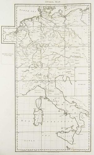
Chauchard, Captain A general map of the empire of Germany, Holland, the Netherlands, Switzerland, the Grisons, Italy, Sicily,
Lot 225
Categories
Estimate:
$350 - $700
Absentee vs Live bid
Two ways to bid:
- Leave a max absentee bid and the platform will bid on your behalf up to your maximum bid during the live auction.
- Bid live during the auction and your bids will be submitted real-time to the auctioneer.
Bid Increments
| Price | Bid Increment |
|---|---|
| $0 | $10 |
| $100 | $10 |
| $200 | $20 |
| $300 | $30 |
| $420 | $30 |
| $480 | $20 |
| $500 | $50 |
| $2,000 | $200 |
| $3,200 | $300 |
About Auction
By Jeschke Jádi Auctions Berlin GmbH
Dec 9, 2016 - Dec 10, 2016
Set Reminder
2016-12-09 06:00:00
2016-12-10 06:00:00
America/New_York
Bidsquare
Bidsquare : Rare Books Decorative Prints Historical Photography
https://www.bidsquare.com/auctions/jeschke-van-vliet/rare-books-decorative-prints-historical-photography-1998
Jeschke Jádi Auctions Berlin GmbH info@jvv-berlin.de
Jeschke Jádi Auctions Berlin GmbH info@jvv-berlin.de
- Lot Description
Chauchard, Captain A general map of the empire of Germany, Holland, the Netherlands, Switzerland, the Grisons, Italy, Sicily, Corsica, and Sardinia. Mit gest. Karte im Frontispiz, gest. Widmungsblatt und 25 (dav. 22 doppelbl.-gr.) Karten. London, Stockdale, 1800. 1 Bl. Folio. HLdr. d. Zt. mit Marmorpapierbezuegen und goldgepr. RTitel (etw. berieben und bestoßen, tls. etw. beschabt). Erste engl. Ausg. - Zusammengesetzt ergeben die einzelnen 25 Karten eine große UEberblickskarte von Mitteleuropa (ca. 215 x 185 cm). - Papier etw. gebraeunt und tls. etw. fleckig. Karten tls. mit Abklatsch und kl. Randlaesuren. Insgesamt wohlerhalten.
- Buyer's Premium


 EUR
EUR CAD
CAD AUD
AUD GBP
GBP MXN
MXN HKD
HKD CNY
CNY MYR
MYR SEK
SEK SGD
SGD CHF
CHF THB
THB


