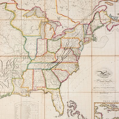
* VISSCHER, Nicolaus (1618-1709). Novi Belgii novaeque Angliae nec non partis Virginiae Tabula. [Amsterdam, ca 1656].
Lot 118
About Seller
Hindman
1338 West Lake Street
Chicago, IL 60607
United States
Recognized as the Midwest's leading fine art auctioneers, Hindman Auctioneers has built a worldwide reputation based on a full service approach to the auction business tailored to meet the individual needs of our clients. Coming from a variety of educational backgrounds, specialists bring years of e...Read more
Categories
Estimate:
$2,000 - $3,000
Absentee vs Live bid
Two ways to bid:
- Leave a max absentee bid and the platform will bid on your behalf up to your maximum bid during the live auction.
- Bid live during the auction and your bids will be submitted real-time to the auctioneer.
Bid Increments
| Price | Bid Increment |
|---|---|
| $0 | $25 |
| $500 | $50 |
| $1,000 | $100 |
| $2,000 | $250 |
| $5,000 | $500 |
| $10,000 | $1,000 |
| $20,000 | $2,500 |
| $50,000 | $5,000 |
| $100,000 | $10,000 |
About Auction
By Hindman
Nov 12, 2018
Set Reminder
2018-11-12 11:00:00
2018-11-12 11:00:00
America/New_York
Bidsquare
Bidsquare : The Fine Cartographic and Printed Americana Collection of Evelyn and Eric Newman
https://www.bidsquare.com/auctions/hindman-auctions/the-fine-cartographic-and-printed-americana-collection-of-evelyn-and-eric-newman-3534
Hindman Bidsquare@hindmanauctions.com
Hindman Bidsquare@hindmanauctions.com
- Lot Description
* VISSCHER, Nicolaus (1618-1709). Novi Belgii novaeque Angliae nec non partis Virginiae Tabula. [Amsterdam, ca 1656].
Engraved map hand-colored in outline, image 465 x 554 mm (sheet 530 x 615 mm). Figural cartouche incorporating view of "Nieuw Amsterdam op t Eylant Manhattan," galleons, canoes, animals, and a Native American Fort. (1 3/4-in. tear to centerfold a bottom repaired on verso and just touching cartouche, 1/2-in tear to left margin with old repair on verso, tiny hole, slightly browned.).
FIRST EDITION, second state, THE EARLIEST OBTAINABLE STATE (preceded by a proof known in only 3 copies), with "t' Fort Kaimier" and without Philadelphia. "Of extreme importance for introducing a view of New Amsterdam in the lower right. This is probably the second published view of the city, the first being that of Joost Hartgers in 1651 ... Of interest is that an example of the second state was used in the first boundary dispute between William Penn and Lord Baltimore of Maryland" (Burden). "No general map of the period has greater significance…in the historical cartography of New England, the Middle States, Maryland, and Virginia" (Wroth, 1942-3, John Carter Brown Annual Report). See Augustyn & Cohen, Manhattan in Maps, pp.32-33; Burden 315 (state 2); see Phillips 506; Tooley The Mapping of America, vol.II, p.284 (second state).
Estimate $2,000-3,000 - Shipping Info
-
Please refer to https://www.lesliehindman.com/shipping-packing/
-
- Buyer's Premium


 EUR
EUR CAD
CAD AUD
AUD GBP
GBP MXN
MXN HKD
HKD CNY
CNY MYR
MYR SEK
SEK SGD
SGD CHF
CHF THB
THB![* VISSCHER, Nicolaus (1618-1709). Novi Belgii novaeque Angliae nec non partis Virginiae Tabula. [Amsterdam, ca 1656].](https://s1.img.bidsquare.com/item/l/3925/3925404.jpeg?t=1GalnL)
![* VISSCHER, Nicolaus (1618-1709). Novi Belgii novaeque Angliae nec non partis Virginiae Tabula. [Amsterdam, ca 1656].](https://s1.img.bidsquare.com/item/s/3925/3925404.jpeg?t=1GalnL)


