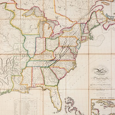
* [SENEX, John]. A New General Atlas. London: for Daniel Browne, 1721.
Lot 111
About Seller
Hindman
1338 West Lake Street
Chicago, IL 60607
United States
Recognized as the Midwest's leading fine art auctioneers, Hindman Auctioneers has built a worldwide reputation based on a full service approach to the auction business tailored to meet the individual needs of our clients. Coming from a variety of educational backgrounds, specialists bring years of e...Read more
Categories
Estimate:
$12,000 - $18,000
Absentee vs Live bid
Two ways to bid:
- Leave a max absentee bid and the platform will bid on your behalf up to your maximum bid during the live auction.
- Bid live during the auction and your bids will be submitted real-time to the auctioneer.
Bid Increments
| Price | Bid Increment |
|---|---|
| $0 | $25 |
| $500 | $50 |
| $1,000 | $100 |
| $2,000 | $250 |
| $5,000 | $500 |
| $10,000 | $1,000 |
| $20,000 | $2,500 |
| $50,000 | $5,000 |
| $100,000 | $10,000 |
About Auction
By Hindman
Nov 12, 2018
Set Reminder
2018-11-12 11:00:00
2018-11-12 11:00:00
America/New_York
Bidsquare
Bidsquare : The Fine Cartographic and Printed Americana Collection of Evelyn and Eric Newman
https://www.bidsquare.com/auctions/hindman-auctions/the-fine-cartographic-and-printed-americana-collection-of-evelyn-and-eric-newman-3534
Hindman Bidsquare@hindmanauctions.com
Hindman Bidsquare@hindmanauctions.com
- Lot Description
* [SENEX, John]. A New General Atlas, Containing a Geographical and Historical Account of All the Empires, Kingdoms and other Dominions of the World. London: for Daniel Browne, Thomas Taylor, et al, 1721.
Folio (538 x 355 mm). Title printed in red and black, 34 double-page engraved maps, all hand-colored in outline except the city plans; 13 pages engraved coats of arms of subscribers, all mounted on stubs. (Vertical creasing to a few leaves at beginning and end, some light spotting, a few pale stains.) Contemporary English sprinkled calf, blind foliate roll-tool border, spine in 8 compartments with 7 raised bands, brown morocco gilt lettering-piece in one, board edges and turn-ins gilt (joints starting, spine ends chipping with minor losses, overall wear).
FIRST EDITION, "chiefly interesting for the copiousness of its information concerning America, which is illustrated by seven immense maps" (Sabin). A New Map of Virginia Mary-Land and the Improved Parts of Pennsylvania & New Jersey, an important depiction of the Chesapeake Bay region, is the 1721 revised state of Christopher Browne's map, which was chiefly derived from Augustine Herrman's earlier surveys of the region in 1673. The map shows the boundary of Delaware, which was still part of Pennsylvania, favoring the claims of Lord Baltimore. Senex's atlas also includes a map of Louisiana and the Mississippi River, dedicated to William Law. Phillips 563; Sabin 79124.
Estimate $12,000-18,000
Provenance: Sir Andrew(?) Agnew, Baronet, Lochnaw (armorial bookplate); Thomas Agnew (signature and shelf mark on preface).
- Shipping Info
-
Please refer to https://www.lesliehindman.com/shipping-packing/
-
- Buyer's Premium


 EUR
EUR CAD
CAD AUD
AUD GBP
GBP MXN
MXN HKD
HKD CNY
CNY MYR
MYR SEK
SEK SGD
SGD CHF
CHF THB
THB![* [SENEX, John]. A New General Atlas. London: for Daniel Browne, 1721.](https://s1.img.bidsquare.com/item/l/3925/3925397.jpeg?t=1GalnL)
![* [SENEX, John]. A New General Atlas. London: for Daniel Browne, 1721.](https://s1.img.bidsquare.com/item/s/3925/3925397.jpeg?t=1GalnL)


