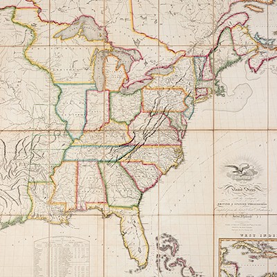
* ROBERT DE VAUGONDY, Didier (1723-1786) Atlas Universel. Paris: By the author and Boudet, 1757.
Lot 105
About Seller
Hindman
1338 West Lake Street
Chicago, IL 60607
United States
Recognized as the Midwest's leading fine art auctioneers, Hindman Auctioneers has built a worldwide reputation based on a full service approach to the auction business tailored to meet the individual needs of our clients. Coming from a variety of educational backgrounds, specialists bring years of e...Read more
Categories
Estimate:
$6,000 - $8,000
Absentee vs Live bid
Two ways to bid:
- Leave a max absentee bid and the platform will bid on your behalf up to your maximum bid during the live auction.
- Bid live during the auction and your bids will be submitted real-time to the auctioneer.
Bid Increments
| Price | Bid Increment |
|---|---|
| $0 | $25 |
| $500 | $50 |
| $1,000 | $100 |
| $2,000 | $250 |
| $5,000 | $500 |
| $10,000 | $1,000 |
| $20,000 | $2,500 |
| $50,000 | $5,000 |
| $100,000 | $10,000 |
About Auction
By Hindman
Nov 12, 2018
Set Reminder
2018-11-12 11:00:00
2018-11-12 11:00:00
America/New_York
Bidsquare
Bidsquare : The Fine Cartographic and Printed Americana Collection of Evelyn and Eric Newman
https://www.bidsquare.com/auctions/hindman-auctions/the-fine-cartographic-and-printed-americana-collection-of-evelyn-and-eric-newman-3534
Hindman Bidsquare@hindmanauctions.com
Hindman Bidsquare@hindmanauctions.com
- Lot Description
* ROBERT DE VAUGONDY, Didier (1723-1786) Atlas Universel. Paris: By the author and Boudet, 1757.
2 volumes, folio (515 x 340 mm). Engraved allegorical title by Charles Baquoy after J. Oger, 103 double-page engraved maps (including 3 folding maps), all hand-colored in outline; avertissment leaf, 17 leaves of descriptive text, 3 leaves of subscriber's names, manuscript list of plates to vol.II. (A few short marginal tears, a few maps with tears to centerfold crossing image, occasional creasing, staining or browning.) Contemporary half diced russia, marbled boards (upper cover to vol.I detached, spine to vol.I perished, joints starting, overall wear).
FIRST EDITION, with maps dating 1749-1756, and with 8 maps relating to the Americas. This copy with all 103 maps as listed in the contents (each numbered and stencilled on verso), but without the optional 5 maps of post roads present in some copies which were available to subscribers for an additional cost of 6 livres. Robert de Vaugondy's Atlas Universel was the most modern atlas of its time, incorporating information from the most recent explorations; the maps of the North American territories, California, and Australia were the most accurate available. The map of Virginia and Maryland is based on Fry and Jefferson's map, and the maps of Canada and South America are based on material held by the Depot de la Marine. Phillips 619; Sabin 71863.
Estimate $6,000-8,000
Provenance: James Yorke (1730-1808), British Clergyman, Bishop of Ely (signatures, bookplate noting his bequest dated 1808); Ely Episcopal Library (bookplate, shelfmark on flyleaf).
- Shipping Info
-
Please refer to https://www.lesliehindman.com/shipping-packing/
-
- Buyer's Premium


 EUR
EUR CAD
CAD AUD
AUD GBP
GBP MXN
MXN HKD
HKD CNY
CNY MYR
MYR SEK
SEK SGD
SGD CHF
CHF THB
THB


