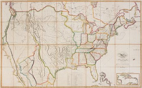
* MELISH, John (1771-1822). Map of the United States....Entered...the 6th day of June, 1816...Improved to the 1st of January, 18
Lot 85
About Seller
Hindman
1338 West Lake Street
Chicago, IL 60607
United States
Recognized as the Midwest's leading fine art auctioneers, Hindman Auctioneers has built a worldwide reputation based on a full service approach to the auction business tailored to meet the individual needs of our clients. Coming from a variety of educational backgrounds, specialists bring years of e...Read more
Categories
Estimate:
$25,000 - $35,000
Absentee vs Live bid
Two ways to bid:
- Leave a max absentee bid and the platform will bid on your behalf up to your maximum bid during the live auction.
- Bid live during the auction and your bids will be submitted real-time to the auctioneer.
Bid Increments
| Price | Bid Increment |
|---|---|
| $0 | $25 |
| $500 | $50 |
| $1,000 | $100 |
| $2,000 | $250 |
| $5,000 | $500 |
| $10,000 | $1,000 |
| $20,000 | $2,500 |
| $50,000 | $5,000 |
| $100,000 | $10,000 |
About Auction
By Hindman
Nov 12, 2018
Set Reminder
2018-11-12 11:00:00
2018-11-12 11:00:00
America/New_York
Bidsquare
Bidsquare : The Fine Cartographic and Printed Americana Collection of Evelyn and Eric Newman
https://www.bidsquare.com/auctions/hindman-auctions/the-fine-cartographic-and-printed-americana-collection-of-evelyn-and-eric-newman-3534
Hindman Bidsquare@hindmanauctions.com
Hindman Bidsquare@hindmanauctions.com
- Lot Description
* MELISH, John (1771-1822). Map of the United States....Entered...the 6th day of June, 1816...Improved to the 1st of January, 1818. Philadelphia, 1818.
Engraved folding map by J. Vallance and H.S. Tanner, overall 915 x 1490 mm, hand-colored in outline, dissected in 40 sections and mounted on linen, cream selvage, marbled paper outer panels. (Some light fraying to selvage, a few pale stains.) Modern cloth folding case.
THE THOMAS W. STREETER COPY
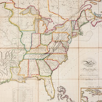
Second state of the 1818 edition, still calling Illinois a Territory. Streeter identifies this map as the first state of the 1818 edition, but it corresponds with Ristow's second state. Streeter's pencil annotations along the border of Illinois and the Northwest Territory demarcate the 42nd and 43rd parallels. The printed dash and dot border between Illinois and the Northwest Territory is south of Chicago (as usual in the second state), and therefore Chicago is included on the map as part of the Northwest Territory; outline coloring in the present copy, however, places the northern border of Illinois further north, closer to the border near the parallel of 42°30' present in the third state (and later) of this edition.
The 1818 edition "differs from that of 1816 by the extension of the northern boundary of Illinois to include Chicago. Due to the inaccuracy in depicting Lake Michigan, however, Chicago could only be included in the state by adding a panhandle extending east to the Lake [present in this copy in hand-colored outline only]. Also, the five districts of Arkansas, Howard, Cape Girardeau, Lawrence and St. Louis appear on the map for the first time. The first two districts approximate the present bounds of Arkansas, the latter three the state of Missouri" (Streeter). Ristow John Melish and His Map of the United States, p.171; Streeter VI:3805 (this copy).
Estimate $25,000-35,000
Provenance: Thomas W. Streeter (pencil annotations, bookplate, his sale, Parke Bernet, 23 April 1969, part VI, lot 3805).
- Shipping Info
-
Please refer to https://www.lesliehindman.com/shipping-packing/
-
- Buyer's Premium


 EUR
EUR CAD
CAD AUD
AUD GBP
GBP MXN
MXN HKD
HKD CNY
CNY MYR
MYR SEK
SEK SGD
SGD CHF
CHF THB
THB


