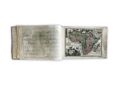
Seutter, Matthaus. Atlas Minor Praecipua Orbis Terrarum Imperia Regna et Provincias, Germanieae Potissimum tabellis 50. exacte delineatis sistens
Lot 155B
Categories
Estimate:
$6,000 - $7,000
Absentee vs Live bid
Two ways to bid:
- Leave a max absentee bid and the platform will bid on your behalf up to your maximum bid during the live auction.
- Bid live during the auction and your bids will be submitted real-time to the auctioneer.
Bid Increments
| Price | Bid Increment |
|---|---|
| $0 | $25 |
| $300 | $50 |
| $1,000 | $100 |
| $2,000 | $500 |
| $5,000 | $500 |
| $10,000 | $1,000 |
| $20,000 | $2,000 |
| $50,000 | $5,000 |
| $100,000 | $10,000 |
| $200,000 | $25,000 |
| $500,000 | $50,000 |
| $1,000,000 | $100,000 |
About Auction
By Guernsey's
Sep 23, 2020
Set Reminder
2020-09-23 12:00:00
2020-09-23 12:00:00
America/New_York
Bidsquare
Bidsquare : The Legendary Vladi Collection of Historical Maps
https://www.bidsquare.com/auctions/guernseys/the-legendary-vladi-collection-of-historical-maps-5507
Featuring over 300 examples of the finest quality antique maps, with proceeds benefiting MapAction, an organization that uses maps to aid those in disaster-stricken areas. Guernsey's auctions@guernseys.com
Featuring over 300 examples of the finest quality antique maps, with proceeds benefiting MapAction, an organization that uses maps to aid those in disaster-stricken areas. Guernsey's auctions@guernseys.com
- Lot Description
Seutter, Matthaus
Atlas Minor Praecipua Orbis Terrarum Imperia Regna et Provincias, Germanieae Potissimum tabellis 50. exacte delineatis sistens usui militiae ducum ac peregrinantium maxime accommodatus opera
1740
Cooperplate engraving; coloured
Printed area: 32.2 x 22 cm; 12.7 x 8.7 in
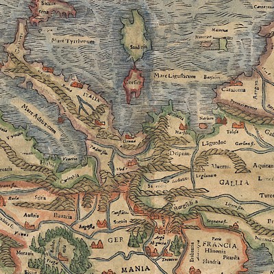
A bound anthology, containing a world map, continent maps of Europe, Asia, Africa and America, and as country maps of Spain, France, Great Britain, the Netherlands, Switzerland, Italy, Germany, Denmark, Poland, Greece, Russia, the Turkish Empire and Palestine. The coloured maps are lavishly decorated with jewelry cartouches, rich figurative work, coats of arms, mileage scales and wind roses. The world map includes additional embellishments in the form of small celestial globes, zodiacs and orbits. Particular attention has been paid to the detailed outlines. No text is contained within the anthology. Single maps protected in unique 20th Century case, maps partially with stamps.
From the Legendary Vladi Collection of Historical Maps which includes 280 examples of the finest quality antique maps brought to auction with proceeds benefiting MapAction, an organization that uses maps and technology to aid those in disaster-stricken areas. Each map is accompanied by a certificate of authenticity issued by the consignor.
Condition: Single maps protected in unique 20th Century case with restored back. Maps partially with light coloured stamps, margin extremities with light brown discolouration; overall excellent condition.
This item will be shipped from Hamburg, Germany. Shipping details are to be coordinated with our recommended shipper - Shipping Info
-
Guernsey's does not provide in-house packing and shipping services. Shipping, handling and insurance costs are the responsibility of the winning bidder. The majority of lots are being sold FOB Hamburg, Germany, and a lesser number of lots are being sold FOB Halifax, Canada. The description of each lot will indicate where the item is located, and from which country shipping to the successful winning bidder can be arranged. Should you wish to learn more about your shipping options, please contact Guernsey's by email at auctions@guernseys.com prior to the auction.
-
- Buyer's Premium


 EUR
EUR CAD
CAD AUD
AUD GBP
GBP MXN
MXN HKD
HKD CNY
CNY MYR
MYR SEK
SEK SGD
SGD CHF
CHF THB
THB


