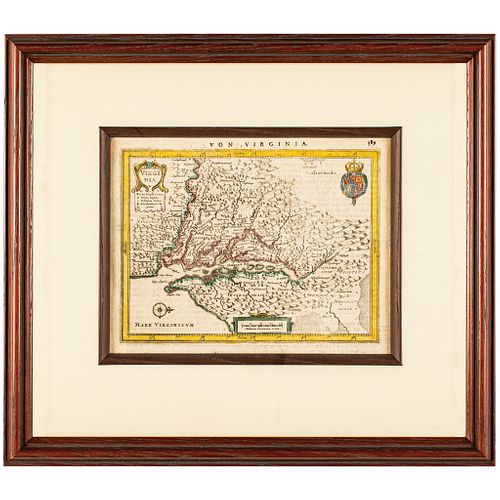
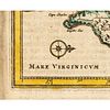
c. 1648 Map, Hand-Colored, VON VIRGINIA (VIRGINIA) by Jan Jansson Framed
Lot 297
Categories
Estimate:
$700 - $900
Absentee vs Live bid
Two ways to bid:
- Leave a max absentee bid and the platform will bid on your behalf up to your maximum bid during the live auction.
- Bid live during the auction and your bids will be submitted real-time to the auctioneer.
Bid Increments
| Price | Bid Increment |
|---|---|
| $0 | $10 |
| $200 | $20 |
| $300 | $25 |
| $500 | $50 |
| $1,000 | $100 |
| $2,000 | $200 |
| $3,000 | $250 |
| $5,000 | $500 |
| $10,000 | $1,000 |
| $20,000 | $2,000 |
| $30,000 | $2,500 |
| $50,000 | $5,000 |
| $100,000 | $10,000 |
| $200,000 | $20,000 |
| $300,000 | $25,000 |
| $500,000 | $50,000 |
About Auction
By Early American History Auctions
Jan 23, 2021
Set Reminder
2021-01-23 12:00:00
2021-01-23 12:00:00
America/New_York
Bidsquare
Bidsquare : Early American History Auction of Autographs, Americana, Political & Maps
https://www.bidsquare.com/auctions/early-american-history-auctions/early-american-history-auction-of-autographs-americana-political-maps-6311
311 Lots of Rare, Historic Autographs, Americana, Civil War Era, George Washington, Abraham Lincoln, Slavery & Black History, Revolutionary War Era, Colonial America, Federal Period, War of 1812, Colonial Currency, Indian Peace Medals & more... Early American History Auctions auctions@earlyamerican.com
311 Lots of Rare, Historic Autographs, Americana, Civil War Era, George Washington, Abraham Lincoln, Slavery & Black History, Revolutionary War Era, Colonial America, Federal Period, War of 1812, Colonial Currency, Indian Peace Medals & more... Early American History Auctions auctions@earlyamerican.com
- Lot Description
Historic Maps
Hand-Colored "VON VIRGINIA" Map by Jan Jansson
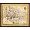
c. 1648 Map, Hand-Colored "VON VIRGINIA" (VIRGINIA) by Jan Jansson, after Capt. John Smith's landmark Map of 1612, Framed, Choice Extremely Fine.
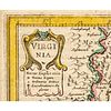
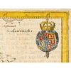
A smaller version of Capt. John Smith's landmark Map of 1612, which was first introduced by Jansson into the Atlas Minor in 1628 and was revised here in 1648, evidently to replace an earlier damaged plate. It presents a fine view of the Chesapeake Bay region including present day Delaware, Maryland, and Virginia. This Map is engraved with mountains, trees, rivers, and numerous Native American Indian villages and decorated with a title Cartouche, the English Royal Arms, a compass rose and strap-work distance scale Cartouche. This Map measures 6.25" x 8" (by sight) and is luxuriously matted and framed to an overall size of 12.5" x 14.25, (not examined out of the frame). Yet we know it has its original German text on the back, and this has been reproduced and attached to the back of the frame. We've seen two other copies on the Internet, one of which sold for $700 in 2006, yet this the first we have offered.
Johannes Janssonius (1588, Arnhem - buried July 11, 1664, Amsterdam) (born Jan Janszoon, in English also Jan Jansson) was a Dutch cartographer and publisher who lived and worked in Amsterdam in the 17th century.
Janssonius was born in Arnhem, the son of Jan Janszoon the Elder, a publisher and bookseller. In 1612 he married Elisabeth de Hondt, the daughter of Jodocus Hondius. He produced his first maps in 1616 of France and Italy. In 1623 Janssonius owned a bookstore in Frankfurt am Main, later also in Danzig, Stockholm, Copenhagen, Berlin, Knigsberg, Geneva and Lyon. Elisabeth Hondius died in 1627 and he remarried Elisabeth Carlier in 1629. In the 1630s he formed a partnership with his brother in law Henricus Hondius, and together they published atlases as Mercator/Hondius/Janssonius.
Under the leadership of Janssonius the Hondius Atlas was steadily enlarged. Renamed Atlas Novus, it had three volumes in 1638, one fully dedicated to Italy. In 1646, a fourth volume came out with "English County Maps", a year after a similar issue by Joan Blaeu. Janssonius' maps are similar to those of Blaeu, and he is often accused of copying from his rival, but many of his maps predate those of Blaeu and/or covered different regions. By 1660, at which point the atlas bore the appropriate name "Atlas Major", there were 11 volumes, containing the work of about a hundred credited authors and engravers. It included a description of "most of the cities of the world" (Townatlas), of the waterworld (Atlas Maritimus in 33 maps), and of the Ancient World (60 maps). The eleventh volume was the Atlas of the Heavens by Andreas Cellarius. Editions were printed in Dutch, Latin, French, and a few times in German.
After Janssonius's death, the publishing company was continued by his son-in law, Johannes van Waesbergen. The London bookseller Moses Pitt attempted publication of the Atlas Major in English, but ran out of resources after the fourth volume in 1683.
- Shipping Info
-
Early American provides in-house worldwide shipping. Please contact us directly if you have questions about your specific shipping requirements.
-
- Buyer's Premium


 EUR
EUR CAD
CAD AUD
AUD GBP
GBP MXN
MXN HKD
HKD CNY
CNY MYR
MYR SEK
SEK SGD
SGD CHF
CHF THB
THB