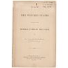
1865, 1868, 1896 Three California Publications, Birds-Eye View Map of California
Lot 300
Estimate:
$500 - $600
Absentee vs Live bid
Two ways to bid:
- Leave a max absentee bid and the platform will bid on your behalf up to your maximum bid during the live auction.
- Bid live during the auction and your bids will be submitted real-time to the auctioneer.
Bid Increments
| Price | Bid Increment |
|---|---|
| $0 | $10 |
| $200 | $20 |
| $300 | $25 |
| $500 | $50 |
| $1,000 | $100 |
| $2,000 | $200 |
| $3,000 | $250 |
| $5,000 | $500 |
| $10,000 | $1,000 |
| $20,000 | $2,000 |
| $30,000 | $2,500 |
| $50,000 | $5,000 |
| $100,000 | $10,000 |
| $200,000 | $20,000 |
| $300,000 | $25,000 |
| $500,000 | $50,000 |
About Auction
By Early American History Auctions
Aug 24, 2019
Set Reminder
2019-08-24 12:00:00
2019-08-24 12:00:00
America/New_York
Bidsquare
Bidsquare : Autographs, Colonial Currency, Political Americana, Historic Guns
https://www.bidsquare.com/auctions/early-american-history-auctions/autographs-colonial-currency-political-americana-historic-guns-4347
Historic Autographs • Colonial Currency • American Civil War Colonial Era • Revolutionary War • Political Americana • Black History Early American History Auctions auctions@earlyamerican.com
Historic Autographs • Colonial Currency • American Civil War Colonial Era • Revolutionary War • Political Americana • Black History Early American History Auctions auctions@earlyamerican.com
- Lot Description
Western America
Three Items "Bird's-Eye View Map of California" & 2 More
1865, 1868 & 1896-Dated, Lot of Three (3) Early Publications on California, including the South Pacific Railroad and the Western States, Fine to Very Fine.
Lot Includes:
1. June 1865-Dated, 24-page Pamphlet titled: "How the Western States Can Become the Imperial Power in the Union," by Dr. William Elder, Treasury Dept., Printed by Ringwalt & Brown, Philadelphia, PA, measuring 8.75" x 5.5", Very Fine. Featuring a contemporary assessment of the riches of the western states which stood to benefit from the post-Civil War industrial boom.
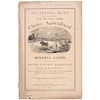
2. 1868-Dated, 42-page Pamphlet titled: "Sectional Maps Showing the Location of One Million Acres Choice Agricultural and Mineral Lands on the Line of the South Pacific Railroad in the State of Missouri," published by the Land Dept., of the South Pacific Railroad, St. Louis, MO. Measuring 9.25" x 6", Good-Fine. Some stains and edge wear to covers, but the printing itself is beautiful with internal pages Very Fine. An exceptional woodcut Cover Engraving, and featuring one Pullout Map of the South Pacific Railroad passing through Missouri, and other Maps of the counties near the railroad lines.
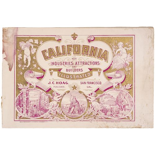
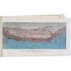
3. 1896-Dated, Imprint titled: "California, Her Industries, Attractions and Builders Illustrated," W. E. Gray, editor, published by J.C. Hoag, printed by The E.D. Taylor Co., with gold and burgundy ink covers, many uncolored engravings, advertisements, and a three-color map: "BIRD'S-EYE VIEW MAP OF CALIFORNIA". The Printed Booklet measures 7.5" x 11", with 130 pages, including covers. The Map and Engravings are worth the estimate alone! Covers with dampstaining and wear, but inside pages are crisp and clean.
A nice historical collection of three vintage publication for collectors of California and Western Railroad memorabilia from the Civil War era onwards. (3 items).
- Shipping Info
-
Early American provides in-house worldwide shipping. Please contact us directly if you have questions about your specific shipping requirements.
-
- Buyer's Premium


 EUR
EUR CAD
CAD AUD
AUD GBP
GBP MXN
MXN HKD
HKD CNY
CNY MYR
MYR SEK
SEK SGD
SGD CHF
CHF THB
THB