1847 Handcolored Folding Map: Phelpss National Map of the United States, Guide
Lot 302
Categories
Estimate:
$550 - $750
Absentee vs Live bid
Two ways to bid:
- Leave a max absentee bid and the platform will bid on your behalf up to your maximum bid during the live auction.
- Bid live during the auction and your bids will be submitted real-time to the auctioneer.
Bid Increments
| Price | Bid Increment |
|---|---|
| $0 | $10 |
| $200 | $20 |
| $300 | $25 |
| $500 | $50 |
| $1,000 | $100 |
| $2,000 | $200 |
| $3,000 | $250 |
| $5,000 | $500 |
| $10,000 | $1,000 |
| $20,000 | $2,000 |
| $30,000 | $2,500 |
| $50,000 | $5,000 |
| $100,000 | $10,000 |
| $200,000 | $20,000 |
| $300,000 | $25,000 |
| $500,000 | $50,000 |
About Auction
By Early American History Auctions
Jan 23, 2021
Set Reminder
2021-01-23 12:00:00
2021-01-23 12:00:00
America/New_York
Bidsquare
Bidsquare : Early American History Auction of Autographs, Americana, Political & Maps
https://www.bidsquare.com/auctions/early-american-history-auctions/early-american-history-auction-of-autographs-americana-political-maps-6311
311 Lots of Rare, Historic Autographs, Americana, Civil War Era, George Washington, Abraham Lincoln, Slavery & Black History, Revolutionary War Era, Colonial America, Federal Period, War of 1812, Colonial Currency, Indian Peace Medals & more... Early American History Auctions auctions@earlyamerican.com
311 Lots of Rare, Historic Autographs, Americana, Civil War Era, George Washington, Abraham Lincoln, Slavery & Black History, Revolutionary War Era, Colonial America, Federal Period, War of 1812, Colonial Currency, Indian Peace Medals & more... Early American History Auctions auctions@earlyamerican.com
- Lot Description
Historic Maps
1847 Map "Phelps's National Map of the United States..."
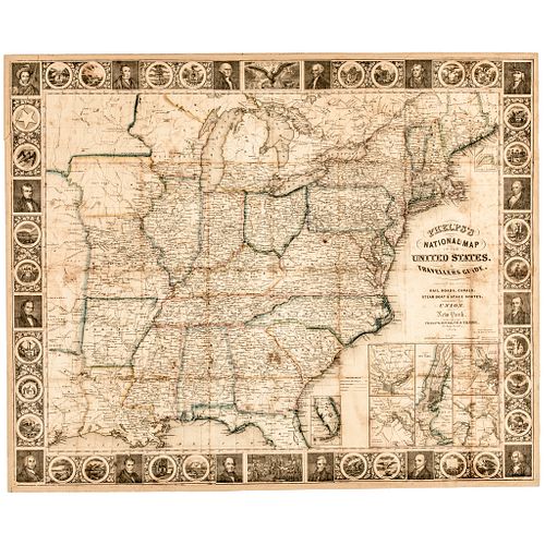
1847-Dated, "Phelps's National Map of the United States, A Traveller's Guide...", Hand-Colored Folding Map of the United States, measuring 26" x 21" with its bound original Traveller's Booklet, New York, 1847, Published by Phelps, Ensigns & Thayer, Fine.
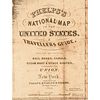
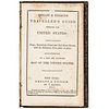
1847 Fold-out Map of the United States fully titled in the cartouche: "Phelps's National Map of the United States, A Traveler's Guide Embracing the Principle Rail-Roads, Canals, Steam-Boat and Stage Routes Throughout the Union". New York, 1847. Published by Phelps, Ensigns & Thayer. The large fold-out Map is accompanied by a bound Volume titled: "Phelps & Ensign's Traveler's Guide Through the United States Containing Stage, Steamboat, Canal and Rail Road Routes, with the Distances from Place to Place, Illustrated by a New and Accurate Map of the United States."
This Map of the United States measures about 26.5" wide by 21.25" height and is mounted on a 19th century thin but stiff heavy paperboard backing having a small repaired break on the blank reverse at the upper left corner and age tone primarily along its folds. Although the Map's cartouche is dated 1848, the Map has a copyright of 1845 and thus we believe that the Map itself was produced in 1845 and the margin embellishments may or may not have been changed in 1847. The accompanying 1844 Traveler's Guide is bound in its original full leather covers which are intact and sound with light edge wear mostly confined to the extremities. The interior pages are complete and tight with some pencil notations to the endpapers and a bit of edge chipping to the front free end paper. This original Traveler's Map is offered along with the 1844 Traveler's Guide Book by the same publishers. (2 items)
This original 1847 Hand-colored Map depicts the first 27 States in beautiful outline color as well as large Iowa and Wisconsin Territories and a portion of Texas (all three states would be admitted to the Union between 1845 (when the map was drawn) and 1847 (when this Guide was published).
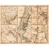
Besides the Map of the United States there is an insert containing maps of American Cities including New York, Boston, Philadelphia, Baltimore, Pittsburgh, Chicago, Cincinnati and St. Louis. Surrounding the map is a border of vignette portraits of the US Presidents up to James Polk along with the State Seals of the first 30 States of the Union. The Map itself shows routes of railroads, canals and stage roads and identifies many Indian tribes and their native lands.
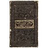
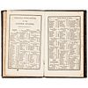
This Map would have originally been bound within the Traveler's Guide and, although the Guide included here, is from 1844 rather than 1847, it is identical in form and format to the Volume that would have originally accompanied this Map. The Guide is bound in its original, gold gilt lettered and decorated, black leather covers which measure approx. 3 3/8" by 5 1/2" and contains a 53 page Traveler's Guide with Railroad, Canal, Stage and Steamboat routes in each of the states and territories. The hand colored folding map would have been tipped onto the inside rear cover of the Guide.
This 1847 Phelps & Ensign Map of the United States is complete and intact with original, outline coloring. As stated above the Map is mounted on a 19th century, paperboard backing to which it has been attached for well over 110 years.
- Shipping Info
-
Early American provides in-house worldwide shipping. Please contact us directly if you have questions about your specific shipping requirements.
-
- Buyer's Premium


 EUR
EUR CAD
CAD AUD
AUD GBP
GBP MXN
MXN HKD
HKD CNY
CNY MYR
MYR SEK
SEK SGD
SGD CHF
CHF THB
THB