1778 World Atlas by Robert De Vaugondy Including a World Map based on Religions
Lot 185
Categories
Estimate:
$5,000 - $7,000
Absentee vs Live bid
Two ways to bid:
- Leave a max absentee bid and the platform will bid on your behalf up to your maximum bid during the live auction.
- Bid live during the auction and your bids will be submitted real-time to the auctioneer.
Bid Increments
| Price | Bid Increment |
|---|---|
| $0 | $10 |
| $200 | $20 |
| $300 | $25 |
| $500 | $50 |
| $1,000 | $100 |
| $2,000 | $200 |
| $3,000 | $250 |
| $5,000 | $500 |
| $10,000 | $1,000 |
| $20,000 | $2,000 |
| $30,000 | $2,500 |
| $50,000 | $5,000 |
| $100,000 | $10,000 |
| $200,000 | $20,000 |
| $300,000 | $25,000 |
| $500,000 | $50,000 |
About Auction
By Early American History Auctions
Mar 20, 2021
Set Reminder
2021-03-20 12:00:00
2021-03-20 12:00:00
America/New_York
Bidsquare
Bidsquare : Autographs-Colonial-Political-Americana
https://www.bidsquare.com/auctions/early-american-history-auctions/autographs-colonial-political-americana-6509
330 Lots of Rare, Historic Autographs, Americana, Civil War Era, George Washington, Abraham Lincoln, Slavery & Black History, Revolutionary War Era, Colonial America, Federal Period, War of 1812, Colonial Currency, Indian Peace Medals & more... Early American History Auctions auctions@earlyamerican.com
330 Lots of Rare, Historic Autographs, Americana, Civil War Era, George Washington, Abraham Lincoln, Slavery & Black History, Revolutionary War Era, Colonial America, Federal Period, War of 1812, Colonial Currency, Indian Peace Medals & more... Early American History Auctions auctions@earlyamerican.com
- Lot Description
American Revolution
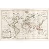
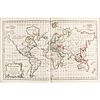
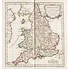
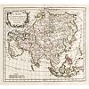
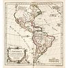
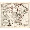
1778 Robert De Vaugondy's World Atlas With Fifty-two Handcolored Dated Maps the World Divided by Religions
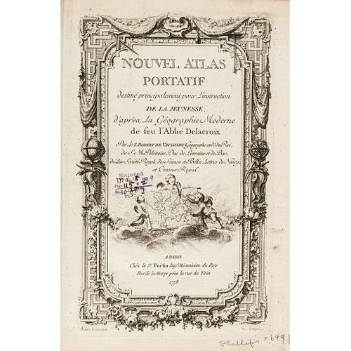
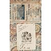
1778-Dated Revolutionary War Period, Hand-Colored Engraved "World Atlas" of (52) Maps titled, "NOUVEL ATLAS PORTATIF destine principalement pour l'instruction de la Jeunesse." or ("New Portable Atlas Intended Primarily for the Instruction of the Young") by Robert De Vaugondy, Paris, Ex: "EARL OF GLASGOW" and baring his Engraved Bookplate, internally Choice Crisp Extremely Fine.
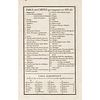
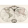
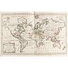
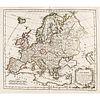
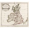
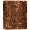
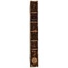
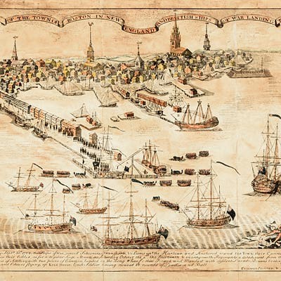
This a a hardcover 1778-Dated, World Atlas by Robert De Vaugondy, who was the Geographer to King Louis XV of France during the American Revolutionary War period. Printed in Paris by Chez le Sr. Fortin, this historic Atlas measures 11.5" x 9.5" and is fully bound in mottled calf worn and scuffed with a red morocco spine label and Gold Gilt-lettered "ATLAS DE ROBER" and decorated embossed stamped along its worn yet intact spine. There is some minor separation of front and back covers from spine, some loss to leather, as well as imprints from the Western Reserve Historical Society on each of the Fifty-two Maps. Some of the more interesting maps include a World map divided by religions as well as several fascinating maps that includes18th century Revolutionary War Period America. Internally, each Copper Plate Engraved Map is sharply impressed, each Double-Page in size, on oversized fresh crisp clean heavy laid period paper, most with the original copper plate's outline embossed in the paper along with a faint oval of the Western Reserve Historical Society. An earlier Atlas, "Atlas Universel. Paris: pour les auteurs et chez Boudet, 1757-[1758]." with 103 double-page engraved maps which were hand-coloured in outline in similar quality, sold at Christie's, London, October 2014, for 6,875 (GBP or roughly $8,800 USD). The current volume Ex: "EARL OF GLASGOW" and baring his Engraved Bookplate on the inside front cover's marbled paper, together with an official deaccessioned printed label Ex: Western Reserve Historical Society (above) with small violet accession stamp completed at left-center of the engraved title page at left of a vignette showing two cherubs designing a Map of the World, title page engraved by Arrivel Delineavil. Each individual Map would exhibit beautifully and have the eye appeal of near mint with fresh bold original hand-color. An important addition to any Revolutionary War era or Map collection.
Gilles Robert de Vaugondy (1688-1766), also known as Le Sieur or Monsieur Robert, and his son, Didier Robert de Vaugondy (1723-1786), were leading mapmakers in France during the 18th century. As such they employed strict standards for accuracy and were most famous for their production of the revolutionarily accurate 'Atlas Universel' published in 1757, as well as for their spectacular terrestrial globes. In 1760, Didier Robert de Vaugondy was appointed official "Geographer" to King Louis XV of France.
Original copperplate-engraved 1778 map by Robert de Vaugondy on Mercator's Projection, with original outline color showing the areas associated with the four major religions of the world: Christianity, Islam, Judaism, and Paganism. The attractive cartography reflects the most recent discoveries of the late 18th century explorers. Australia is outlined in full, including an attached Tasmania, as is New Zealand. In North America, there is scant detail between Hudson Bay, marked as an English possession, and the Pacific Coast, where a printed note alludes to Russian discoveries.
Our Auction Contents:
Black History & Slavery: (Lots 1 - 63)
Abraham Lincoln Related: (Lots 64 - 74)
Historic Autographs: (Lots 75 - 235)
Colonial America: (Lots 236 - 261)
Revolutionary War: (Lots 262 - 304)
George Washington Related: (Lots 305 - 306)
Early American Guns & Weapons: (Lots 307 - 318) - Shipping Info
-
Early American provides in-house worldwide shipping. Please contact us directly if you have questions about your specific shipping requirements.
-
- Buyer's Premium


 EUR
EUR CAD
CAD AUD
AUD GBP
GBP MXN
MXN HKD
HKD CNY
CNY MYR
MYR SEK
SEK SGD
SGD CHF
CHF THB
THB