1883 Surveyor's Diary of William B. Lawson, Engineer for the Chicago, Burlington, & Quincy Railroad
About Seller
6270 Este Ave.
Cincinnati , OH 45232
United States
With offices in Cincinnati, Cleveland and Denver, Cowan’s holds over 40 auctions each year, with annual sales exceeding $16M. We reach buyers around the globe, and take pride in our reputation for integrity, customer service and great results. A full-service house, Cowan’s Auctions specializes in Am...Read more
Two ways to bid:
- Leave a max absentee bid and the platform will bid on your behalf up to your maximum bid during the live auction.
- Bid live during the auction and your bids will be submitted real-time to the auctioneer.
Bid Increments
| Price | Bid Increment |
|---|---|
| $0 | $25 |
| $500 | $50 |
| $1,000 | $100 |
| $2,000 | $250 |
| $5,000 | $500 |
| $10,000 | $1,000 |
| $20,000 | $2,500 |
| $50,000 | $5,000 |
| $100,000 | $10,000 |
About Auction
Jun 21, 2019
On June 21, Cowan’s Auctions will be offering a remarkable selection of historic photography, letters, documents, flags, political ephemera, and more representing the Revolutionary War-period through the Civil War, Indian Wars, and beyond, as well as the American West. Cowan's Auctions dawnie@cowans.com
- Lot Description
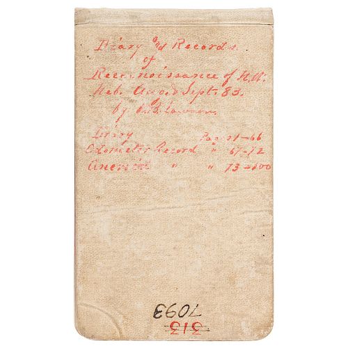
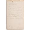
Diary of surveyor William Bateman Lawson (1846-1901), dated 1883, with details of a survey expedition through western Nebraska for the Chicago, Burlington & Quincy Railroad, 100pp, approx. 4.25 x 6.75 in. Handwritten title on front cover reads "Diary and Records of Reconnaissance of N. W. Neb. August & Sept. 83. by W. B. Lawson." The diary includes an odometer record for his journey as well as aneroid barometer readings.
William B. Lawson was a lifelong railroad man who was eulogized upon his death as possessing "an enviable reputation for accuracy that rendered him one of the best known engineers of the West" ( Rocky Mountain News, Denver, January 28, 1901). Born and educated in Illinois, in 1867 Lawson entered the employ of the Chicago, Burlington, & Quincy Railroad as a rodman. In the ensuing years Lawson's career advanced rapidly keeping pace with the explosive growth of the railroad industry. "The Burlington," as the Chicago, Burlington, & Quincy Railroad came to be known, would come to serve a wide area with extensive trackage in both the Midwest and Rocky Mountain regions. Lawson's diary reflects The Burlington's planned expansion westward through Nebraska and further into Colorado and Wyoming. The route explored is described by Lawson as "Kenesaw to Fort Laramie via the Middle Loup - Sanke and Niobrara Rivers & Raw Hide Creek / Fort Laramie to Grand Island to Grand Island [sic] Via No. Platte & So. Loup Rivers." This route would take him through the northwest portion of the state to Fort Robinson, and then across the Wyoming border and down to Fort Laramie, then east again towards central Nebraska.
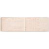
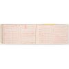
The diary commences with a list of items purchased at Lowell, NE, and a guide for computing the height of mountains, then proceeds with its first entry on 7/27/1883. Lawson writes on 7/28 that he placed the odometer on his wagon and marks the entry with "Camp No. 1." The dates and camp numbers specified throughout the diary are significant as they correlate directly to two tables at the end of the diary which record the odometer record and the aneroid barometer readings. Included in these detailed tables are general remarks as well as specifics regarding locality, weather, elevation, and more.
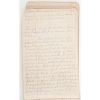
Lawson's daily diary entries reflect the standard observations expected from a surveyor including descriptions of land surface, soil, water features, wildlife, and man-made improvements such as ranches, roads and trails. Typical of his style is this entry from Monday, September 23: "Camp No 33 about 21 miles below Ft Laramie. near point of White bluffs. / Got started about 7:30 our time 6:40 by sun about. Stopped at Post and got some feed, Laramie has more and better buildings than Robinson some large concrete buildings Brick Barracks & wooden houses. came down the Platte on south side. The first 2 or 3 miles heavy with sand afterwards Roads fine the most of the way. Valley irregular in width and quality, but a mile or more wide generally, and a good deal of very fair and some excellent land. Hills high and gravely...got dinner at Chamberlain & Doty's Ranch 9 miles out. Some pastures fenced...." Noteworthy is Lawson's description of the historic Camp Clark toll bridge. Overall, an engaging and fascinating narrative portrait of the Nebraskan frontier of 1883.Good overall condition given wear and age. Some minor soil particularly on cover but also on interior pages. Notebook has separated from spine but cover remains attached. First two pages entirely separated from binding. Mix of pencil and various color inks. Blue lined pages with handwriting that is easily legible.Condition
- Shipping Info
-
Buyers are required to pay for all packing, shipping and insurance charges. Overseas duty charges are the responsibility of the successful Bidder. Be aware that for larger and/or valuable items, shipping charges can be substantial. - If there is no shipping amount on listed your invoice, you will need to make arrangements to pick up or ship your purchase through an alternative shipping company. Our shipping department can be contacted at 513.871.1670 (ext. 219) or email shipping@cowans.com. - Shipping charges include insurance for your order while in transit. If you have private insurance we will adjust your charge to include only packing and shipping. - Please allow 14 – 21 days after payment to package and ship your purchase as carefully as possible.
-
- Buyer's Premium


 EUR
EUR CAD
CAD AUD
AUD GBP
GBP MXN
MXN HKD
HKD CNY
CNY MYR
MYR SEK
SEK SGD
SGD CHF
CHF THB
THB